Catalog Archive
Auction 156, Lot 337

Colton's Rare Map Depicting the Gold Region of California

"Map of California, Oregon, Texas, and the Territories Adjoining with Routes &c.", Colton, Joseph Hutchins

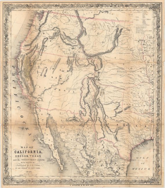
Subject: Western United States & Mexico

Period: 1849 (dated)

Publication:

Color: Hand Color

Size:
18.1 x 20.8 inches
46 x 52.8 cm
Download High Resolution Image
(or just click on image to launch the Zoom viewer)

This map was issued to meet the huge demand for information concerning the gold deposits in California and was published in J. Quinn Thornton's Oregon and California in 1848. According to Wheat, it is a combination of 1848 maps by Fremont and Tanner one year prior to statehood. It covers the western United States from Independence, Missouri to the Pacific Ocean. Several overland trails are depicted including the Oregon Trail, Fremont's route and Kearney's route. Numerous Indian tribes are located and a table at top indicates the distances from New York and Panama to points west. Published by D. Appleton & Co.

References: Wheat (TMW) #593; Wheat (Gold) #73; Howes #T223.

Condition: B

Issued folding with light toning along the folds, a few small folds separations that are mostly closed on verso with archival tape, and occasional scattered foxing.

Estimate: $1,400 - $1,700

Sold for: $1,000

Closed on 2/17/2016

Archived