Catalog Archive
Auction 156, Lot 240

"[Lot of 3] Map of a Reconnaissance from Carroll Montana Ter. to the Yellowstone National Park and Return... [and] Judith Basin... [and] Upper Geyser Basin... ", Ludlow, William (Capt.)

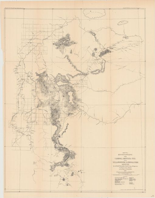
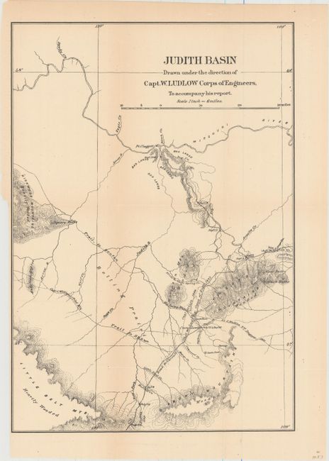
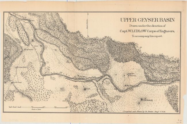
Subject: Northwestern United States

Period: 1876 (published)

Publication:

Color: Black & White

Size:
See Description
Download High Resolution Image
(or just click on image to launch the Zoom viewer)

Carl Wheat hypothesizes that Capt. William Ludlow (1843 - 1901), Corps of Engineers, was assigned the task of surveying the road from Carroll, Montana on the Missouri to Fort Ellis near Bozeman as a reward for good service, since it allowed him to inspect the wonders of Yellowstone without a furlough. In his report, Ludlow says "My own interest in this land of wonder is so keen as to lead me again to hope that it will be protected from the vandalism which it has already suffered, and that the suggestion of an accurate topographical and geological survey, to complete the work so well inaugurated by Professor Hayden, may be made the subject of favorable consideration and recommendation by the Chief of Engineers." Included in his report (not present) were the following three maps:

A. Map of a Reconnaissance from Carroll Montana Ter. to the Yellowstone National Park and Return..., dated 1875 (19.2 x 24.9"). This map describes the newly opened Carroll Road. The road cut more than 200 miles from the previous route between Helena and Corinne. This resulted in a savings of about fifteen days considering the 12 or 13 miles per day the heavy bull-trains averaged. The map shows a large area from the Missouri River in the north to Helena in the west and the newly established National Park in the south. The flow of the Yellowstone, Musselshell, and Missouri Rivers are designated. It has a partial look to it; the Topographical Engineers were rigorous about showing only features they had actually surveyed. Land forms are shown with what appears to be contour lines but there is no interval stated, and Wheat calls it a pseudo-contour map. Carroll was washed away by a flood in the 1880’s and no trace of it remains today. Ironically, it is not named on the map itself.

B. Judith Basin Drawn Under the Direction of Capt. W. Ludlow Corps of Engineers, to Accompany His Report, (12.0 x 17.2"). Covers the region from Ft. Claggett south to the Snowy Mountains. Shows the Carroll Road, several trails, topography and drainage. Much of the area is labeled "wooded" or "heavily wooded."

C. Upper Geyser Basin Drawn Under the Direction of Capt. W. Ludlow Corps of Engineers, to Accompany His Report, (15.3 x 8.8"). Depicts the Upper Geyser Basin area adjacent to the Firehole River and identifies many of its geysers including Old Faithful, Beehive and Castle to name a few.

References: Wheat (TMW) #1257-1259.

Condition: B+

Issued folding with even-age toning. There is one short edge tear and one separation on the first map that have both been closed on verso with archival tape.

Estimate: $275 - $350

Sold for: $325

Closed on 2/17/2016

Archived