Catalog Archive
Auction 156, Lot 195

"Air Navigation Map No 2. (Experimental) Washington, D.C. to Uniontown, PA. & Wheeling, W. VA.", U.S. Army

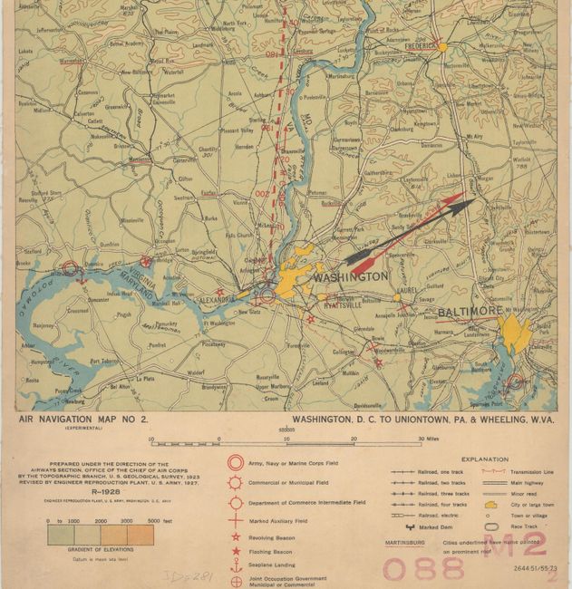
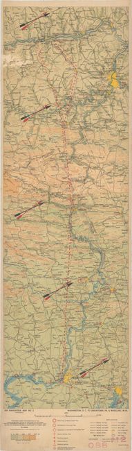
Subject: Mid-Atlantic United States

Period: 1928 (dated)

Publication:

Color: Printed Color

Size:
10.2 x 32.3 inches
25.9 x 82 cm
Download High Resolution Image
(or just click on image to launch the Zoom viewer)

In 1921, the United States Army Air Corps initiated a compressive evaluation of aeronautical charts in an effort to develop a standardized map for aerial navigation. Based upon this study, the Air Corps issued 63 air navigation maps covering most of the military routes in the United States. Prior to 1926, these maps were jointly compiled by the Geological Survey and U. S. Army Engineer Reproduction Plant. By 1926, the preparation of air maps shifted to the U.S. Coast and Geodetic Survey (under the Commerce Department) with the passage of the Air Commerce Act. Maps from this point on were intended to merge the growing commercial airways system with the military network.

This map covers the area from Washington, DC and Baltimore, Maryland to Pittsburgh, Pennsylvania and Wheeling, West Virginia. The map shows elevation and contours, cities and towns, rivers, roads and railroads. Airfield classifications are shown with different symbols. True north and magnetic north are depicted. On a scale of 8 miles per inch.

References:

Condition: B

A colorful example with light toning and some abrasions at top left. Backed in linen. Ex-library stamp on verso.

Estimate: $100 - $130

Unsold

Closed on 2/17/2016

Archived