Catalog Archive
Auction 156, Lot 120

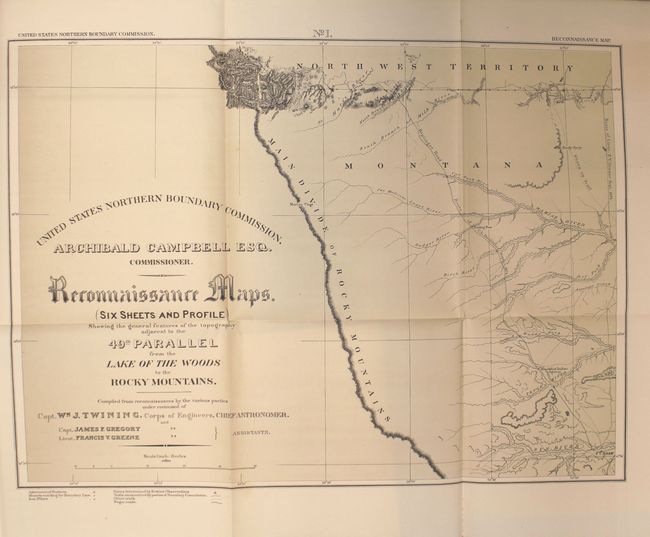
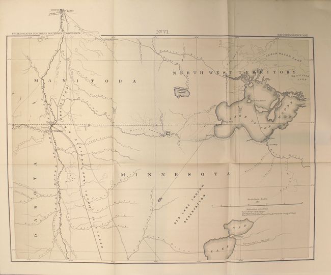
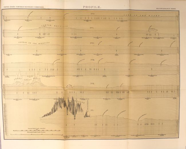
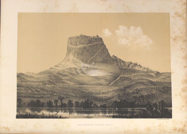
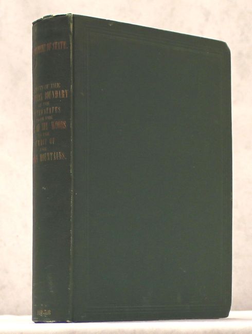
"Reports upon the Survey of the Boundary Between the Territory of the United States and the Possessions of Great Britain from the Lake of the Woods to the Summit of the Rocky Mountains...", Twining, William J. (Capt.)

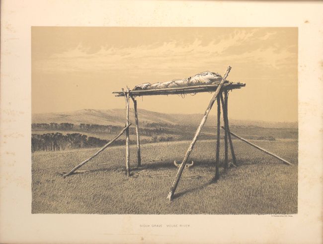
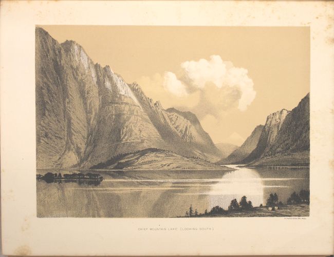
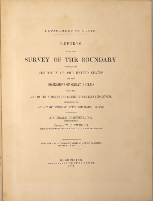
Subject: Canada & United States, Boundary Surveys

Period: 1878 (published)

Publication: 44th Congress, 2nd Session, Sen. Ex. Doc. 41

Color: Black & White

Size:
9.8 x 12.1 inches
24.9 x 30.7 cm
Download High Resolution Image
(or just click on image to launch the Zoom viewer)

This is the complete, 624-page report of the Northern Boundary Survey. In 1872, Congress authorized a survey to determine and mark the United States-Canada boundary line along the 49th parallel. The survey accurately determined the boundary, and added very detailed topographical features in a 5-mile wide strip along the line. The survey was completed in 1875 and published here in 1878 by Archibald Campbell, Boundary Commissioner, and William Twining, Captain of the Corps of Engineers. At the back of the volume are six large folding maps and one profile. These maps cover the area from the Rocky Mountains in Montana to the Lake of the Woods in Minnesota and 100 miles north to south. They provide excellent detail of rivers, towns and forts, springs, and topographical data. Locates the Blackfoot Indian Agency, Ft. Shaw, Ft. Benton, River Crow Indian Agency, Ft. Belknap, Old Fr. Browning, Ft. Turnay, Ft. Peck, Ft. Hawley, Ft. Buford, Ft. Berthold, Ft. Stevenson, Ft. Totten, Ft. Pembina, and Ft. Garry (Canada), plus numerous trading posts, Indian villages, and more.

In addition to the folding maps are 15 lithographic plates including Chief Mountain (frontispiece), Ojibway Camp, Half Breed Hunters Camp and a Sioux Grave. Several other charts, small folding maps and tables are also interspersed within the text. Hardbound in green pebbled cloth with gilt title on spine.

References: Wheat (TMW) #1289.

Condition: B+

The large folding maps at the back of the report are very good to near fine with just a few spots of foxing along one fold on two of the maps. The text has light, uniform toning and the lithographic plates have scattered foxing primarily in the blank margins. Hinges are starting, covers show light wear, and the edges are bumped.

Estimate: $400 - $500

Sold for: $200

Closed on 2/17/2016

Archived