Catalog Archive
Auction 156, Lot 112

NO RESERVE

"Map Showing the Electoral Divisions of the Dominion of Canada. Sheet No. 2",

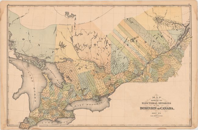
Subject: Eastern Canada

Period: 1881 (published)

Publication: Dominion of Canada Atlas

Color: Hand Color

Size:
24.9 x 16.9 inches
63.2 x 42.9 cm
Download High Resolution Image
(or just click on image to launch the Zoom viewer)

This uncommon map was published by H. Parsell & Co. for the Dominion of Canada Atlas. The map shows the southern portions of Ontario and Quebec surrounding the Great Lakes and depicts the electoral divisions circa 1881. On the verso are the portraits of numerous elected officials within the region.

References:

Condition: B+

Minor soiling with several damp stains along the edges of the sheet, just entering the map border in a few spots. A 1" tear and a 2" centerfold separation at bottom have been closed on verso with archival tape.

Estimate: $50 - $65

Sold for: $34

Closed on 2/17/2016

Archived