Catalog Archive
Auction 155, Lot 705

"A Survey of the Settlement in New South Wales New Holland",

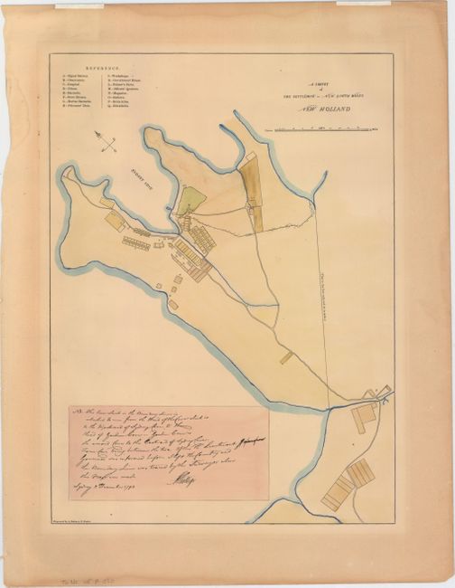
Subject: Sydney, Australia

Period: 1886 (published)

Publication: Picturesque Atlas of Australia

Color: Hand Color

Size:
10.3 x 14.1 inches
26.2 x 35.8 cm
Download High Resolution Image
(or just click on image to launch the Zoom viewer)

This is a lithographed version of a manuscript map of the penal colony established in New South Wales, known as Syndey. The map was originally commissioned by Governor Arthur Phillip to mark the boundary line of the city, and was drawn by Lieutenant Dawes in 1789, one year after the establishment of the settlement. A lettered key identifies the buildings of the settlement, which are shown in close proximity to Sydney Cove and the Tank Stream, which offered fresh water. The boundary line of the city is shown at right, and there is an accompanying note by Governor Phillip dated 2 December 1792:

"This line which is the Boundary Line is intended to run from the head of the Cove which is to the westward of Sydney Cove, to the head of Garden Cove - Garden Cove is the second Cove to the eastward of Sydney Cove: Farm Cove being between the two. Of this the Lieutenant [word crossed out] Governor was informed before I left the country and the Boundary Line was traced by the Surveyor when this Map was made."

The Governor had also ordered that no land within the limits of Sydney could be granted or leased, but was for the use of the Crown and the inhabitants of Sydney. Engraved by A. Dulon and L. Poates and published in Andrew Garran's Picturesque Atlas of Australia. Not in Tooley.

References:

Condition: B+

Light toning with minor damp stains and a couple of short tears confined to the edges of the sheet. Remnants of hinge tape along top edge of sheet.

Estimate: $200 - $230

Sold for: $100

Closed on 11/18/2015

Archived