Catalog Archive
Auction 155, Lot 675
"Partie Occidentale de l'Afrique ou se Trouve la Barbarie Divisee en Royaumes...", Fer, Nicolas de
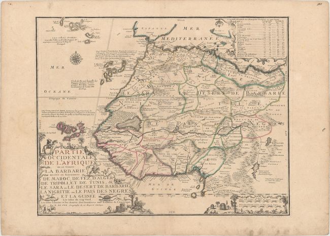
Subject: Northwestern Africa
Period: 1709 (circa)
Publication: Atlas ou Recueil de Cartes Geographiques
Color: Hand Color
Size:
23.4 x 18.5 inches
59.4 x 47 cm
Download High Resolution Image
(or just click on image to launch the Zoom viewer)
(or just click on image to launch the Zoom viewer)