Catalog Archive
Auction 155, Lot 243

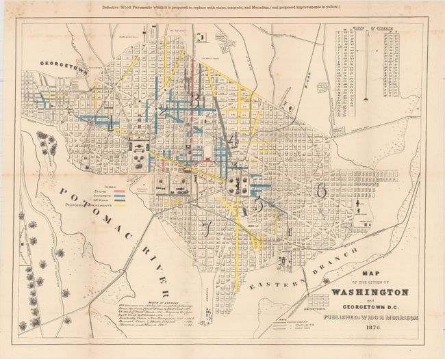
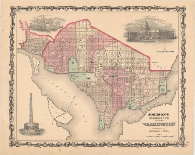
"[Lot of 2] Map of the Cities of Washington and Georgetown D.C. [and] Johnson's Georgetown and the City of Washington the Capital of the United States of America",

Subject: Washington, D.C.

Period: 1862-76 (circa)

Publication:

Color:

Size:
See Description
Download High Resolution Image
(or just click on image to launch the Zoom viewer)

A. Map of the Cities of Washington and Georgetown D.C., by W.H. & O.H. Morrison, dated 1876, printed color (20.0 x 16.1"). This plan was drawn to show the "Defective Wood Pavements" proposed to be replaced with stone, concrete and Macadam. Defective streets are delineated in yellow overprinting. Table gives widths of all streets. Legend locates steam railroads, street cars and chariot routes. This map was originally issued with a seven-page report written by the Commissioners of the District of Columbia to the U.S. Senate. Condition: Issued folding with light foxing and a bit of color offsetting.

B. Johnson's Georgetown and the City of Washington the Capital of the United States of America, by Johnson & Ward, circa 1862, hand color (15.4 x 12.5"). This fine, nineteenth century plan of the city also portrays three large vignettes of The Capitol, Washington Monument, and the Smithsonian Institution. All major streets and buildings are named. The map is surrounded with a decorative, metalwork border typical of the earlier Johnson maps. Condition: Pleasant faint toning and a few spots of foxing.

References:

Condition: B+

See description above.

Estimate: $200 - $250

Sold for: $600

Closed on 11/18/2015

Archived