Catalog Archive
Auction 155, Lot 158

"Map of the Northern Provinces of the United States", Phillips, Richard (Sir)

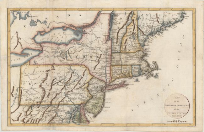
Subject: New England & Mid-Atlantic

Period: 1799 (circa)

Publication: Marshall's Life of Washington

Color: Hand Color

Size:
20.1 x 12.8 inches
51.1 x 32.5 cm
Download High Resolution Image
(or just click on image to launch the Zoom viewer)

This map covers all of the Northeast and Mid-Atlantic, extending south to below Alexandria and west to beyond Wheeling on the Ohio River. Early county development in Pennsylvania is current to 1794, prior to the organization of Greene and Lycoming Counties. The Lands of the Six Nations appear in western New York beside Lake Erie. There is very good detail of roads throughout the region. Engraved by John Russell Jr.

References: McCorkle #799.7; Phillips (M) p. 873.

Condition: B

Folding, as issued, with light offsetting and marginal soiling. A hole in western New York has been infilled, with minor loss of image. Two vertical tears through Maryland and Pennsylvania have been repaired with archival materials. Folds have been reinforced on verso with Japanese tissue.

Estimate: $350 - $425

Sold for: $250

Closed on 11/18/2015

Archived