Catalog Archive
Auction 154, Lot 99

"A New Map of Ye North Parts of America According to the Division Thereof by the Articles of Peace...", Moll, Herman

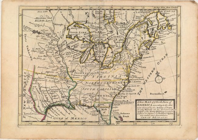
Subject: Colonial Eastern United States & Canada

Period: 1763 (circa)

Publication:

Color: Hand Color

Size:
10.8 x 7.8 inches
27.4 x 19.8 cm
Download High Resolution Image
(or just click on image to launch the Zoom viewer)

This small map depicts the eastern United States and Canada shortly after the French & Indian War. The war ended French colonial ambitions in North America and was one of the most significant developments in a century of Anglo-French conflict. The British colonies extend to the Mississippi River including the large Virginia, North Carolina, South Carolina and Georgia. The map is filled with interesting notations in the central region including "Parts Unknown" in the Great Plains and "Morasses and Brooken Land" in Canada, as well as numerous Indian place names and forts.

References:

Condition: A

Original outline color on watermarked paper with minor marginal soiling.

Estimate: $550 - $650

Sold for: $400

Closed on 9/16/2015

Archived