Catalog Archive
Auction 154, Lot 727

"Bowles's New Pocket Map of the Discoveries Made by the Russians on the North West Coast of America...", Bowles & Carver

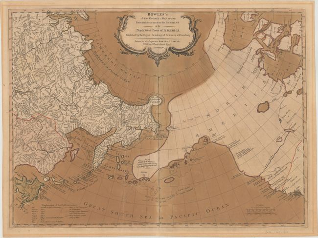
Subject: North Pacific Ocean

Period: 1780 (circa)

Publication:

Color: Hand Color

Size:
24.1 x 17.7 inches
61.2 x 45 cm
Download High Resolution Image
(or just click on image to launch the Zoom viewer)

This map is Bowles & Carver's uncommon reissue of Thomas Jefferys' map from 1761. It is based on Gerhard Mueller's map of 1758, which was one of the first to correctly depict the Kurile Islands and also suggest the outline of Alaska and the Aleutian chain. It shows great detail of the Arctic coast of Siberia based on Vitus Bering's second Kamchatka expedition from 1733-43, and illustrates the sea routes made by Captains Bering and Chirikof. In the largely unexplored North America, the River of the West is boldly shown extending to Lake Winipigon. The discoveries of several different explorers are shown along the coast, including those of Bering, Tschirikow, and Sir Francis Drake. The map includes a decorative title cartouche. A key at bottom left translates Russian geographical terms.

References: Wagner #597.

Condition: B

Original color with heavy oxidation of the green and blue pigments within Japan and the seas. The paper is stable and there is no cracking.

Estimate: $700 - $950

Sold for: $450

Closed on 9/16/2015

Archived