Catalog Archive
Auction 154, Lot 474

"Comitatus Flandriae tam Oriet quam Occid. Ad usum Serenissimi Burgundiae Ducis", Jaillot/Mortier

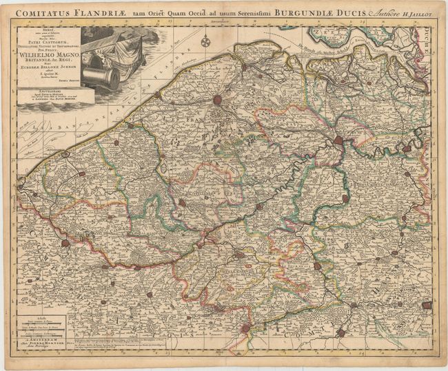
Subject: Western Belgium

Period: 1705 (circa)

Publication:

Color: Hand Color

Size:
24.3 x 19.2 inches
61.7 x 48.8 cm
Download High Resolution Image
(or just click on image to launch the Zoom viewer)

This map depicts west and east Flanders, extending from the Westerschelde south to Douai, France, and as far east as Mons. The map is filled with details of roads, towns, political boundaries, rivers, forested areas, and more. Large towns are depicted as miniature bird's-eye plans. A large dedication cartouche features flags and a cannon.

References:

Condition: B+

Original color with a hint of toning along centerfold and a professionally repaired centerfold separation that enters 2" into map at bottom. There is a crease at bottom right and very minor soiling.

Estimate: $160 - $190

Unsold

Closed on 9/16/2015

Archived