Catalog Archive
Auction 154, Lot 403

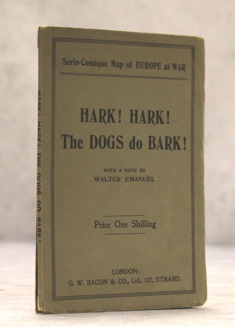
Rare Political Caricature Pocket Map of Europe

"Hark! Hark! The Dogs Do Bark!", Bacon, G. W. & Company
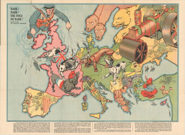
Subject: Europe

Period: 1914 (dated)

Publication:

Color: Printed Color

Size:
27.6 x 19 inches
70.1 x 48.3 cm
Download High Resolution Image
(or just click on image to launch the Zoom viewer)

This very rare political caricature map of Europe depicts the continent at the outbreak of World War I, or as it was called at the time the Great War. The principal countries in the conflict are depicted as the Dogs of War. Germany is identified as an aggressive Dachshund attached to its Austrian ally shown as a yapping mongrel. Opposing them is the dandified French Poodle and the British Bulldog who has chomped onto the Dachshund's nose. Russia is depicted both as a traditional bear and as a massive steamroller driven into the heart of Europe by a determined-looking Tsar. A giant British sailor is puppeteer for a huge naval fleet, while a Turk with his pet Dachshund controls a small German fleet in the Black Sea. The other countries are also boldly caricatured with humorous illustrations - a Spanish bullfighter; a knife-wielding Greek; an Italian carabinieri; a Swiss mountaineer; and a Serbian mosquito. It would take a good deal of study to understand the totality of this map's political and satirical nuances. The title draws on the Mother Goose nursery rhyme. At bottom is explanatory text by Walter Emanuel. Issued in blue paper wrappers.

Although the human personification of continents and countries can be seen as early as the 14th century (on maps by Opicinus de Canestris), human and animal metaphors on maps reached a new level in Europe between 1845 and 1945 with political cartoon maps. The rise of these satirical maps reflected the momentous political and cultural changes that occurred during the time. Political leaders were caricaturized and European nations were given symbolic identities that lent humor and accessibility to the geographical map. Based on popular stereotypes, these visual representations even found their way into the classroom to help bring geography and politics to life. Original serio-comic maps are very scarce due to their ephemeral nature.

References:

Condition: B+

A clean, bright example. Issued folding with two short fold separations at top that just pass the neatline and a couple of short tears below the title cartouche. The paper wrappers are faded, split along the centerfold, and the back cover is torn.

Estimate: $3,000 - $3,750

Sold for: $2,200

Closed on 9/16/2015

Archived