Catalog Archive
Auction 154, Lot 230

"The Harbor of Wood's Hole Massachusetts from a Trigonometrical Survey Under the Direction of A.D. Bache...", U.S. Coast Survey

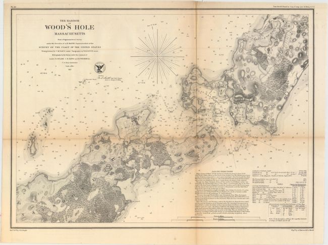
Subject: Cape Cod, Massachusetts

Period: 1857 (dated)

Publication:

Color: Black & White

Size:
17.4 x 12.6 inches
44.2 x 32 cm
Download High Resolution Image
(or just click on image to launch the Zoom viewer)

The Office of Coast Survey is the oldest U.S. scientific organization, dating from 1807 when Congress directed that a "survey of the coast" be carried out. By 1836, it was called the U.S. Coast Survey and in 1878, the name was changed to the U.S. Coast and Geodetic Survey. Today the Office of Coast Survey is a division of the National Oceanic and Atmospheric Administration NOAA.

The survey teams, composed of civilians as well as Army and Naval officers, charted the nation's waterways and produced a wide array of reports, survey charts, hydrographic studies of tides and currents, astronomical studies and observations, and coastal pilots. These charts are an important record of the changing nature of the nation's coastlines. In additional to coastal charts, the U.S. Coast and Geodetic Survey produced land sketches, Civil War battle maps, and the early aeronautical charts.

This attractive chart produced by the Coast Survey features excellent coastal detail. It also identifies individual buildings within Wood’s Hole including a Blacksmith Shop, Bar Neck Wharf, Yellow House and New Church. The water is filled with hundreds of soundings, hazards, sea-bottom type identifiers, and buoys. Sailing directions, information about the tides, and a key for the abbreviations used for seafloor type classification appear beneath the title. Drawn by W. T. Bright and engraved by A. Petersen and E.A. Maedel.

References:

Condition: B

Issued folding and now flattened and backed with tissue. There is toning along the folds and one tiny fold separation that has been repaired on verso.

Estimate: $100 - $130

Sold for: $50

Closed on 9/16/2015

Archived