Catalog Archive
Auction 154, Lot 207
"[Lot of 4] Barra y Puerto de Sn. Agustin [and] Boca y Barra del Rio Sn. Juan [and] Boca y Barra del Rio Nasau [and] Boca y Barra del Rio Sta. Maria", Direccion de Hidrografia
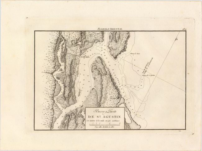
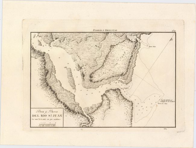
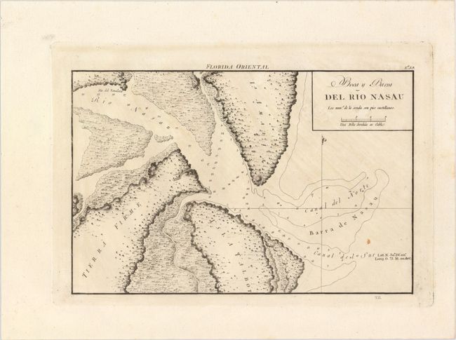
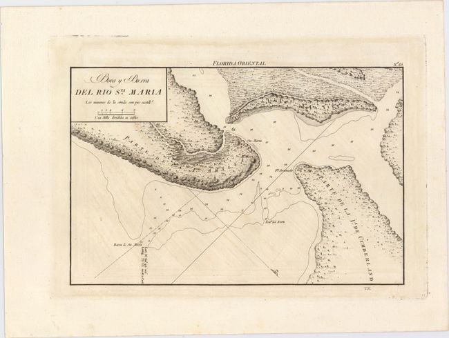
Subject: Eastern Florida
Period: 1818 (published)
Publication: Portulano de la America Setentrional…
Color: Black & White
Size:
10.5 x 6.9 inches
26.7 x 17.5 cm
Download High Resolution Image
(or just click on image to launch the Zoom viewer)
(or just click on image to launch the Zoom viewer)