Catalog Archive
Auction 154, Lot 151

One of the Earliest Maps to Depict West Virginia

"Johnson's Pennsylvania Virginia Delaware and Maryland", Johnson & Ward

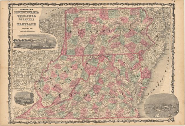
Subject: Mid-Atlantic United States

Period: 1863 (published)

Publication:

Color: Hand Color

Size:
24.4 x 17.2 inches
62 x 43.7 cm
Download High Resolution Image
(or just click on image to launch the Zoom viewer)

This handsome map of the Mid-Atlantic states appeared in Johnson's atlases in 1863. It is the first version of this map to include the new state of West Virginia. The name "Virginia" is still seen spilling into the lower portion of the new West Virginia. Counties, towns and cities, roads, and railroads are located. The map features three striking vignettes, depicting the University of Virginia, Richmond, the capital of the Confederacy at the time, and Fort Monroe in Hampton. Surrounded by a lovely strapwork border.

References:

Condition: B+

Light toning with a few spots of foxing in the image.

Estimate: $130 - $160

Sold for: $140

Closed on 9/16/2015

Archived