Catalog Archive
Auction 154, Lot 107

Scarce Large-Scale Chart of the Coast of New England

"Carte Reduite des Costes Orientales de l'Amerique Septentrionale 1re. Feuille Contenant l'Isle Royale, l'Accadie, la Bay Francoise, la Nouvelle Angleterre et la Nouvelle Yorc...", Bellin, Jacques Nicolas

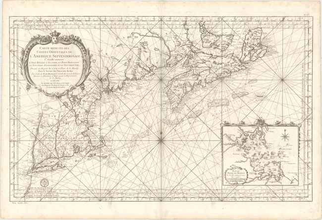
Subject: Colonial Northeastern United States & Canada

Period: 1757 (dated)

Publication: Hydrographie Francoise

Color: Black & White

Size:
34.9 x 21.6 inches
88.6 x 54.9 cm
Download High Resolution Image
(or just click on image to launch the Zoom viewer)

Scarce early issue of this superb large chart of the coast of New England from just below Long Island through Nova Scotia and including Prince Edward Island (here called St. Jean). The coastline is extremely detailed and there is also good detail in the interior, particularly of the rivers. The most significant feature is the large inset of Boston harbor, Plan du Havre de Baston. The chart is very decorative with a large title cartouche, decorative border surrounding the inset, a large compass rose, and rhumb lines. The engraved seal of the Depot de la Marine appears at bottom left, and the price of trente sols appears below the neatline. This is the first state prior to the addition of rhumb lines in the inset map.

References: McCorkle #757.2.

Condition: B

A dark impression on a sturdy sheet of watermarked paper with soiling and a small damp stain around the compass rose. There are two short worm tracks along the neatline at bottom right and left.

Estimate: $2,400 - $3,000

Unsold

Closed on 9/16/2015

Archived