Catalog Archive
Auction 153, Lot 93

NO RESERVE

"Map of North America Showing Its Political Divisions, and Recent Discoveries in the Polar Regions", Mitchell, Samuel Augustus

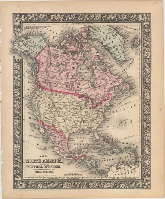
Subject: North America

Period: 1860 (dated)

Publication:

Color: Hand Color

Size:
10.2 x 13.6 inches
25.9 x 34.5 cm
Download High Resolution Image
(or just click on image to launch the Zoom viewer)

This map covers the area from Greenland south to Panama, with the tracks of McClure and Kane shown in the Arctic. Alaska overall is called Russian America. Numerous towns and cities are identified, and there is good topographical detail. "Constructed" and engraved by W. Williams.

References:

Condition: A

A dark impression with a couple minor spots and a few tiny chips on the left edge of the sheet, well away from image.

Estimate: $30 - $40

Sold for: $50

Closed on 5/20/2015

Archived