Catalog Archive
Auction 153, Lot 773

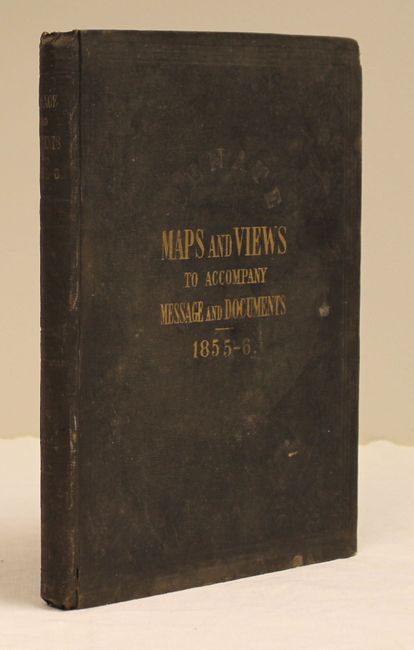
"Message from the President of the United States to the Two Houses of Congress ... Part IV...", U.S. Government

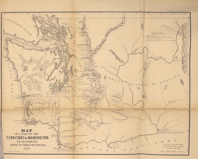
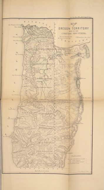
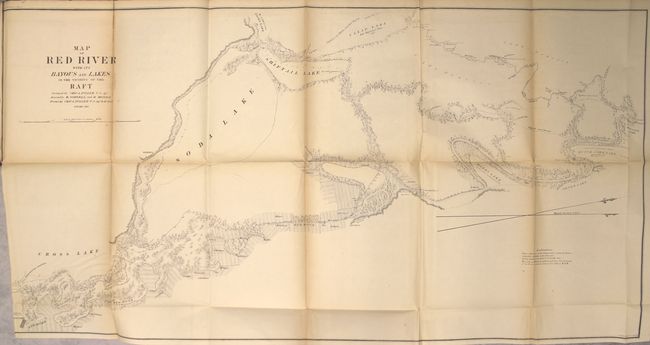
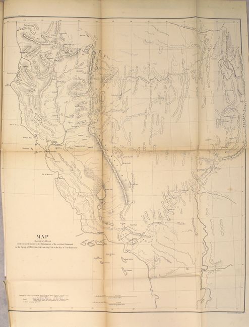
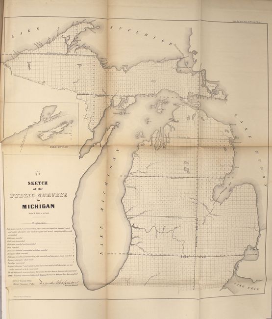
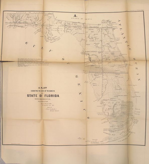
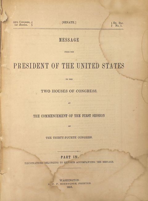
Subject: Exploration & Surveys

Period: 1856 (published)

Publication: Sen Ex. Doc. 1, 34th Cong., 1st Sess.

Color: Black & White

Size:
8.8 x 11.9 inches
22.4 x 30.2 cm
Download High Resolution Image
(or just click on image to launch the Zoom viewer)

This is the nearly complete volume of illustrations accompanying the reports submitted for the 1st session of the 34th Congress (missing only the "Map of Public Surveys in California"). The 34 illustrations are primarily from the General Land Office (15) and Bureau of Topographical Engineers (13), but also include a few from the Quartermaster General and Secretary of the Navy. Of particular interest in this volume are:

Map of a Part of the Territory of Washington to Accompany Report of Surveyor General (19.3 x 14.3"). This uncommon map was executed by James Tilton, Surveyor General, from the Olympia office. This is the first GLO map of Washington Territory, issued just 28 months after its creation. The map shows limited survey progress with modest detail west of the Cascades. In the east, only major rivers are shown. Several forts (Steilacom, Nisqually, Walla Walla, & Townsend) are located and Seattle is labeled Statle. Legend at upper right identifies surveyed lines, surveys under progress, townships subdivided, and proposed surveying for the 1856 & 57 season.

Map Showing the Different Routes Travelled over by the Detachments of the Overland Command in the Spring of 1855 from Salt Lake City, Utah to the Bay of San Francisco (18.5 x 22"). This uncommon map accompanied the "Report of Capt. R. Ingalls on the march of L. Col. Steptoe from Ft. Leavenworth to California" in 1854 and 1855. Wheat states "it is a document of first quality.. showing three important routes." Steptoe was looking for a new and shorter route from the Great Salt Lake to the Pacific Coast. In addition to the route chosen by Steptoe, the routes of two detachments are also traced - one under Capt. Ingalls, the other by Lt. Mowry. The map extends to include all of California and part of Oregon to above the Rogue River. It stretches eastward to name G.S. Lake City, the Mormon capital of Fillmore, Cedar City and Fort Yuma on the Colorado. References: Wheat (TMW) #868; Wagner & Camp #256.

Map of Red River with its Bayous and Lakes in the Vicinity of the Raft (46 x 23.5"). Large map shows soundings in the Red River from Shreveport to its confluence with Red Bayou. The 13-mile length of the river is marked and tributaries, topography, and adjacent lakes are indicated. Dutch Johns, Marks, Soda and Shiftail lakes are located. Ownership of numerous land holdings are also noted on this detailed chart.

Hardbound in original embossed cloth boards with gilt titles on front cover and spine.

References:

Condition: B+

The maps are very good with light toning along the folds. Three maps have fold separations, including the map of Florida (2.3" at left), the map of the Red River (2" at top), and the map of the Territory of Washington (3" at right). Title page and endpapers are toned and damp stained. Covers are stained and rubbed.

Estimate: $250 - $325

Sold for: $150

Closed on 5/20/2015

Archived