Catalog Archive
Auction 153, Lot 74

NO RESERVE

"Western Hemisphere", Teesdale, Henry

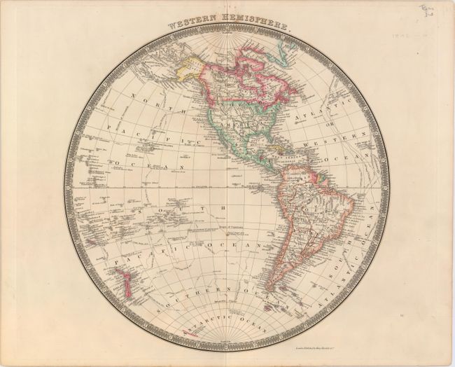
Subject: Western Hemisphere - America

Period: 1842 (circa)

Publication: A New General Atlas of the World

Color: Hand Color

Size:
13.5 x 13.5 inches
34.3 x 34.3 cm
Download High Resolution Image
(or just click on image to launch the Zoom viewer)

The United States and Great Britain established in 1818 joint claim over the Oregon Territory - the region north of Spanish controlled Upper California up to the southern boundary of Russia's Alaska Territory at North latitude 54°40'. By the late 1830's this arrangement was beginning to fall apart. In the 1840's the expansionist Democrats, including their 1844 presidential candidate, James Polk, claimed the entire region for the United States. Their expansionist desires were expressed by Polk's famous campaign slogan, "Fifty-four Forty or Fight!" The slogan also became a rally cry for Americans desiring to settle the territory. Following Polk's election, the dispute was resolved by the 1846 Treaty of Oregon, which struck a compromise that fixed the U.S./Canadian boundary at 49º North.

This finely engraved British hemispheric map shows the continents with a surprising amount of detail including rivers, place names, Indian Tribes, and coastal detail; locates Buenos Ayres, Mexico [City], Santa Fe, Santa Barbara, etc. The map extends to show the South Pacific Islands and New Zealand. All of the important voyages of Capt. Cook and Clerke are specified. In North America, the United States is depicted with its western boundary along the Rocky Mountains and in the Northwest. The border with Canada is left open-ended with British coastal claims extending to the Columbia River, relating England's position on the Fifty-Four Forty dispute. The Independent Republic of Texas is depicted. Surrounded by a keyboard-style circular border.

References:

Condition: A

A crisp impression with just a few spots of foxing at top.

Estimate: $150 - $180

Sold for: $46

Closed on 5/20/2015

Archived