Catalog Archive
Auction 153, Lot 425

"A New and Accurate Map of Peru and the Country of the Amazones. Drawn from the Most Authentick French Maps &c. and Regulated by Astronomical Observations", Bowen, Emanuel

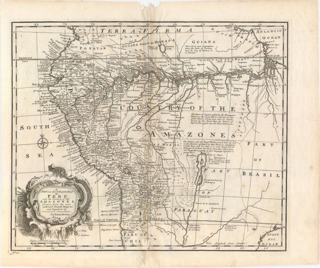
Subject: Central South America

Period: 1747 (published)

Publication: A Complete System of Geography

Color: Black & White

Size:
16.5 x 13.8 inches
41.9 x 35.1 cm
Download High Resolution Image
(or just click on image to launch the Zoom viewer)

This copper-engraved map is filled with detail of the west coast of South America and the Amazon River system. The map extends from Ecuador south well into Chili. The western coastal areas are fully developed and well mapped with hundreds of place names, including Quito, Lima, Cusco, and La Paz. There are several interesting notations including one locating gold and silver along the mythical Xarayes Lake. Another mythical lake, Parima Lake, is located in Guiana. The map is adorned with a decorative title cartouche.

References: Shirley (BL Atlases) T.BOW-2A #55.

Condition: B+

A dark impression with light toning along the centerfold, several printer's creases at right, and a few faint spots of foxing. There are several worm holes in the top blank margin and at bottom entering 1" into map, with the bottom worm holes professionally repaired with a minor amount of the image replaced in facsimile.

Estimate: $110 - $140

Sold for: $65

Closed on 5/20/2015

Archived