Catalog Archive
Auction 153, Lot 336

Unusual Map Depicting Deseret

"Vereinigte Staaten von Nord-America und Mexico", Radefeld, Carl Christian Franz

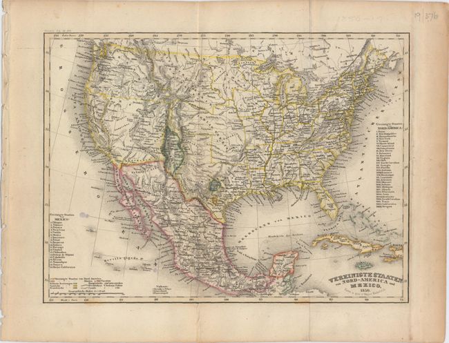
Subject: United States & Mexico, Texas

Period: 1850 (dated)

Publication: Meyer's Zeitungs Atlas

Color: Hand Color

Size:
10 x 7.5 inches
25.4 x 19.1 cm
Download High Resolution Image
(or just click on image to launch the Zoom viewer)

Very attractive, highly detailed map with unusual configurations of the western territories of the United States. Texas is in its early "stovepipe" configuration with an elongated panhandle that extends northward, nearly to 40°. In Texas the French Franz Col. colony and the German Mainzer Verein colony are highlighted in text and separate hand coloring. A very large territory of Deseret encompasses most of the Southwest, while California only extends south to Yerba Buena. New Mexico Territory is a small area squeezed between Texas and the Continental Divide and includes Santa Fe and Taos. The large Indian Territory encompasses today's Oklahoma, Kansas, and part of Nebraska. An uncommon map that is very finely engraved in the German style.

References:

Condition: B+

Issued folding with a couple of tiny spots and a few tiny pinholes visible when held to light.

Estimate: $180 - $220

Sold for: $120

Closed on 5/20/2015

Archived