Catalog Archive
Auction 153, Lot 287

"The Hibbard and Van Hook State Map of Montana",
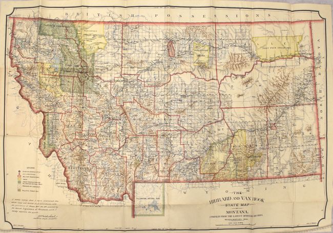
Subject: Montana

Period: 1902 (dated)

Publication:

Color: Printed Color

Size:
32.5 x 21.9 inches
82.6 x 55.6 cm
Download High Resolution Image
(or just click on image to launch the Zoom viewer)

This attractive folding map of Montana was issued 13 years after statehood. Highly detailed, the map depicts Indian, Military and Forest Reservations as well as U.S. Land Offices and the Surveyor General’s Office. The river systems and topography are well developed. Drawn on a scale of 18 miles per inch. Published by John Hibbard and John Van Hook and compiled from the most recent official records. Folds into brown paper wrappers.

References:

Condition: A

A colorful example, issued folding, with pleasant light toning. Paper wrappers are held together with masking tape at spine with a small chip at bottom.

Estimate: $400 - $500

Sold for: $300

Closed on 5/20/2015

Archived