Catalog Archive
Auction 153, Lot 161

"Map of Maine New Hampshire and Vermont, Compiled from the Latest Authorities", Finley, Anthony

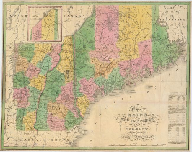
Subject: New England - United States

Period: 1826 (dated)

Publication: A New American Atlas...

Color: Hand Color

Size:
21.4 x 16.9 inches
54.4 x 42.9 cm
Download High Resolution Image
(or just click on image to launch the Zoom viewer)

This folding version of Finley's atlas map delineates the counties, roads, limited watershed, scores of towns and villages. The "Statistical Table" gives populations by county for 1810 and 1820. Maps from Finley's folio A New American Atlas are scarce, but the 15 maps were also published in a rare pocket atlas version that is scarcer still. The maps in this issue were printed on thin paper folding into 3.5" x 6" format. This example is from an edition published between 1827 and 1830. Ristow says, "The same plates, with dates and publisher's name changed, were used by S. Augustus Mitchell in 1831 for an atlas published under the same title as Finley's 1826 volume." This map does not contain Mitchell's imprint and appears as an unrecorded edition published by Finely prior to his collaboration with Mitchell. Drawn by Vance and engraved by J. H. Young.

References: cf. Philips (A) #1378; Ristow, p. 270.

Condition: B+

Issued folding on thin, banknote style paper with a few tiny splits at fold intersections and minor toning along a few folds. A short tear and some paper weakness in border at left has been archivally repaired. Narrow, but adequate, margins all around.

Estimate: $350 - $425

Unsold

Closed on 5/20/2015

Archived