Catalog Archive
Auction 152, Lot 783
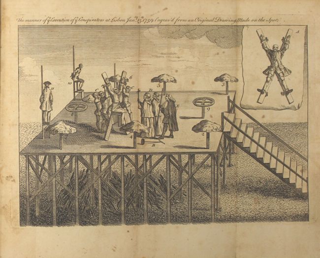
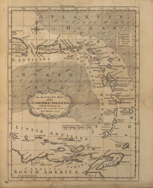
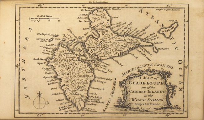
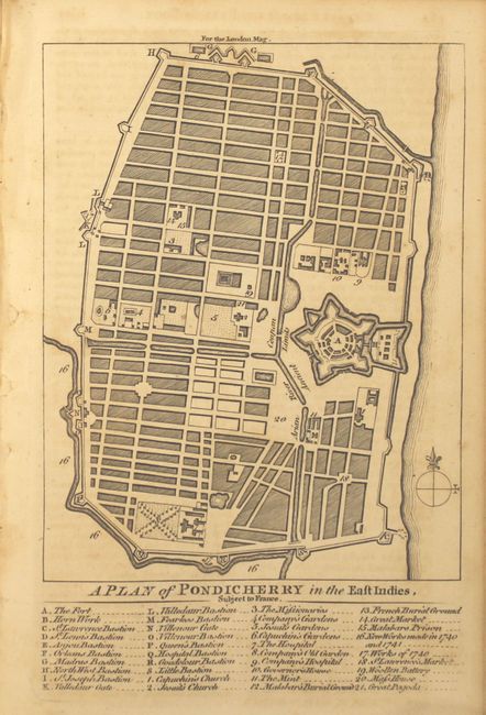
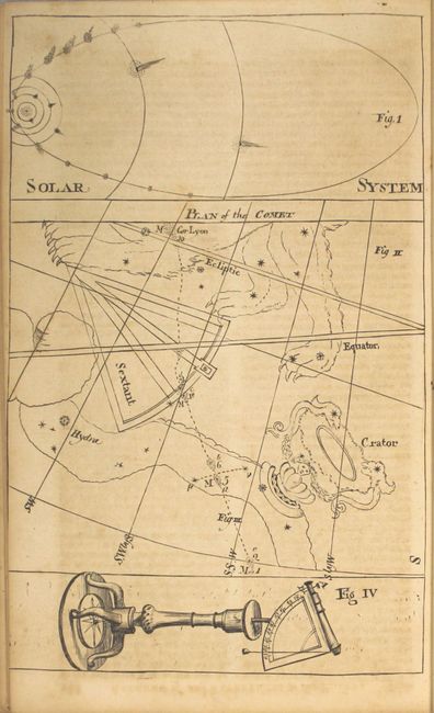
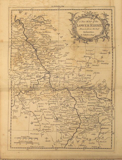
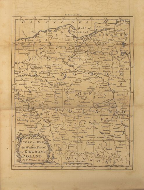
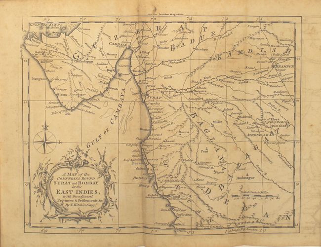
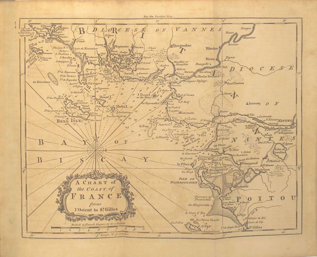
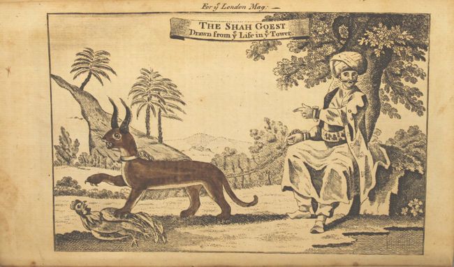
"The London Magazine: or, Gentleman's Monthly Intelligencer", Baldwin, Robert
1 of 11
Subject: Miscellaneous Books
Period: 1759 (published)
Publication:
Color: Black & White
Size:
5.6 x 8.8 inches
14.2 x 22.4 cm
Download High Resolution Image
(or just click on image to launch the Zoom viewer)
(or just click on image to launch the Zoom viewer)