Catalog Archive
Auction 152, Lot 613

"Carte des Indes et de la Chine Dressee sur Plusieurs Relations Particulieres Rectifiees par Quelques Observations", Delisle/Covens & Mortier

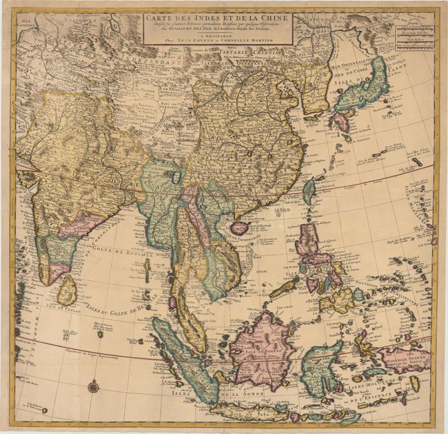
Subject: Eastern, Southern & Southeast Asia

Period: 1730 (circa)

Publication:

Color: Hand Color

Size:
24.5 x 24 inches
62.2 x 61 cm
Download High Resolution Image
(or just click on image to launch the Zoom viewer)

This large, attractive map covers the vast region extensively explored by the Europeans with particular emphasis on the trade routes on the mainland and the islands of the Philippines and the East Indies. In Japan, Hokkaido (Terre d' Yeco ou d'Eso) is attached to the Asian mainland, and the Sea of Japan is named Mer Orientale ou Mer de Coree. Korea is correctly shown as a peninsula, although much too wide. The mythical Lac de Chiamay appears in present-day Burma with several rivers flowing south. The map is filled with details of towns, roads, rivers and topography. Two sheets, joined, as issued.

References:

Condition: B+

A dark impression that is uneven at top left and around Thailand, with original color that has been partially refreshed. Issued folding with professional repairs to several fold separations at bottom, and a horizontal printer's crease along the Tropic of Cancer.

Estimate: $700 - $900

Sold for: $550

Closed on 2/18/2015

Archived