Catalog Archive
Auction 152, Lot 605

"L'Asie Divisee en ses Principaux Etats", Janvier/Lattre
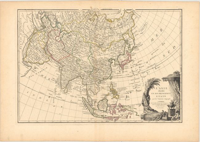
Subject: Asia

Period: 1762 (circa)

Publication: Lattre’s Atlas Moderne…

Color: Hand Color

Size:
17.7 x 12.3 inches
45 x 31.2 cm
Download High Resolution Image
(or just click on image to launch the Zoom viewer)

A beautifully engraved map that illustrates the state of geographic knowledge just prior to the momentous explorations in the Pacific that completed cartographic knowledge of the region. The North Pacific shows the sketchy concepts of the strait of Anian, Terre de Jean de Gama and a stretch of land supposedly sighted by Tschirikow and Delisle in 1741. The northern part of Japan is incompletely mapped and the sea between Japan and Korea is noted as the Mer de Coree, reflecting the Russian sources for much of the map. The stunning title cartouche features rich silks and tapestries, a smoking incense censor, and exotic jewels.

References:

Condition: A

Crisp impression and original outline color with a hint of toning along centerfold and a couple insignificant spots in blank margins.

Estimate: $200 - $275

Sold for: $150

Closed on 2/18/2015

Archived