Catalog Archive
Auction 152, Lot 604

"A New & Accurate Map of Asia Drawn from Actual Surveys, and Otherwise Collected from Journals; Assisted by the Most Approved Modern Maps & Charts...", Bowen, Emanuel
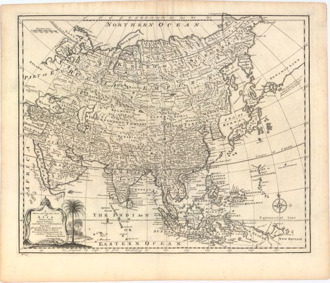
Subject: Asia

Period: 1752 (circa)

Publication: A Complete Atlas…

Color: Black & White

Size:
16.8 x 13.9 inches
42.7 x 35.3 cm
Download High Resolution Image
(or just click on image to launch the Zoom viewer)

A finely engraved map of Asia and South East Asia filled with information. Hokkaido (Yesso) appears as an island, to the east of which is a large land mass labeled De Gama's Land named for the Portuguese captain who reported sighting land in the northern Pacific in the seventeenth century. The Sea of Japan is named the Sea of Korea, and the Carolines are called New Philippines and are located too far west. Decorated with a pictorial title cartouche and a nice compass rose.

References: cf. Yeo #136; Shirley (BL Atlases) T.BOW-2c.

Condition: A

Crisp impression with a bit of light surface soil, else very fine. A short tear in left blank margin has been closed on verso with archival tape.

Estimate: $200 - $230

Sold for: $210

Closed on 2/18/2015

Archived