Catalog Archive
Auction 152, Lot 518

"Nouvelle Carte du Royaume de Dalmacie Divise en Ses Comtes, Territoires, etc la Morlaquie, la Bosnie, et la Servie, Partie de la Hongrie...", Ottens, Reiner and Joshua

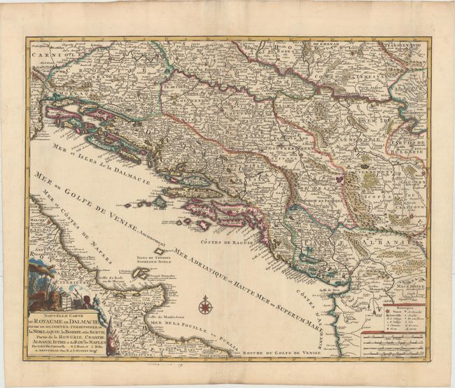
Subject: Western Balkans

Period: 1740 (circa)

Publication:

Color: Hand Color

Size:
22.5 x 18.1 inches
57.2 x 46 cm
Download High Resolution Image
(or just click on image to launch the Zoom viewer)

Very fine and detailed map of the Adriatic Sea focusing on the Balkan nations. The map is fully engraved to show mountains, forests, cities, fortifications and even tiny villages. The map is based on the work of Delisle, Coronelli, Rossi and Nolin who are attributed in the cartouche. Decorated with a compass rose and a fine cartouche.

References:

Condition: B+

Original outline color with later coloring in the cartouche. Issued folding with minor soiling and professional repairs to several fold separations.

Estimate: $275 - $350

Sold for: $180

Closed on 2/18/2015

Archived