Catalog Archive
Auction 152, Lot 445

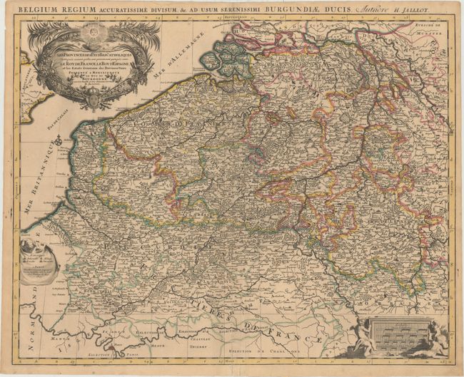
"Les Provinces des Pays-Bas Catholiques Distinguees Suivant Quelles sont Presentement Partagees Entre le Roy de France, le Roy d'Espagne, et les Estats Generaux des Provinces-Unies...", Jaillot/Mortier

Subject: Western Europe

Period: 1693 (dated)

Publication:

Color: Hand Color

Size:
24.3 x 19.1 inches
61.7 x 48.5 cm
Download High Resolution Image
(or just click on image to launch the Zoom viewer)

This splendid, large map of the Low Countries covers present-day Belgium and Luxembourg, extending north to Rotterdam, Netherlands and south to Paris, France. The map is filled with details of political boundaries, towns, rivers and forested areas. The map is handsomely adorned with three cartouches featuring putti, symbols of wealth, and the Sun King emblem with the Latin motto Nec Pluribus Impar (not unequal to many). An additional Latin title appears above the map: "Belgium Regium Accuratissime Divisum, &c. ad usum Serenissimi Burgundiae Ducis."

References:

Condition: B+

Original outline color with light toning and a professionally repaired centerfold separation that enters 4" into image at bottom.

Estimate: $200 - $230

Sold for: $120

Closed on 2/18/2015

Archived