Catalog Archive
Auction 152, Lot 408
"The Continuation of the Road from London to Aberistwith", Ogilby, John
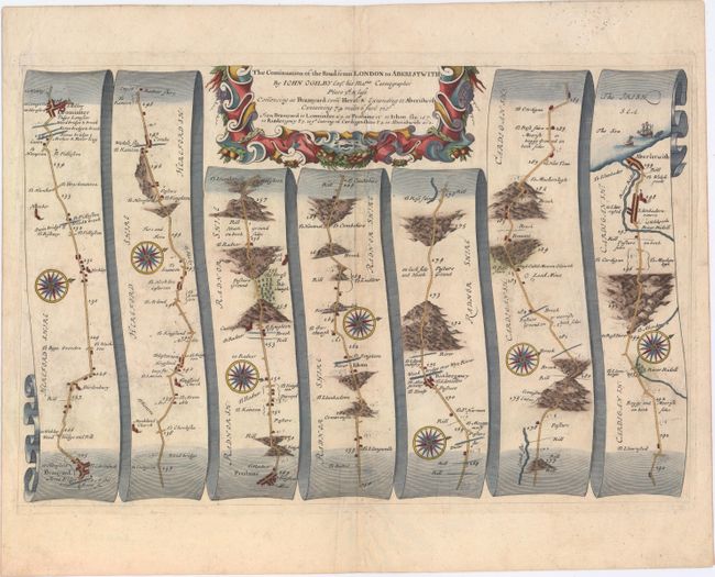
Subject: Western England & Wales
Period: 1675 (circa)
Publication: Britannia…
Color: Hand Color
Size:
18.3 x 12.1 inches
46.5 x 30.7 cm
Download High Resolution Image
(or just click on image to launch the Zoom viewer)
(or just click on image to launch the Zoom viewer)