Catalog Archive
Auction 152, Lot 179

NO RESERVE

"Map, No 3, Showing Continuation of Details of Fort Smith and Santa Fe Route, from Mounds Near the 100 1/2 Degree of W. Longitude to Tucumcari Creek", Simpson, James H. (Lt. Col.)

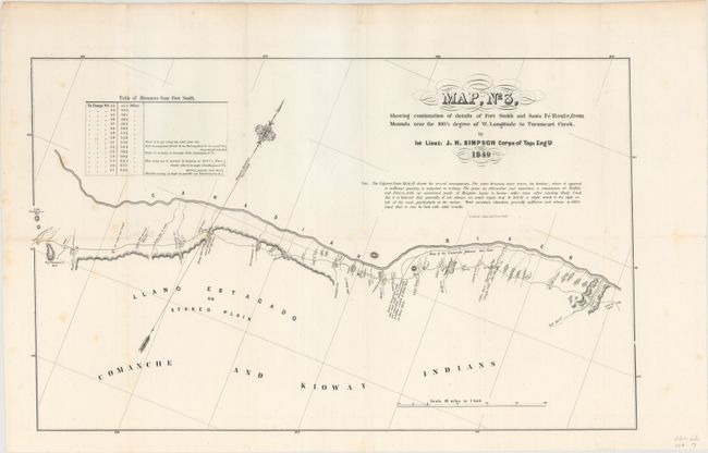
Subject: Oklahoma, Texas

Period: 1849 (dated)

Publication: Sen. Ex. Doc. 12, 31st Cong., 1st Sess.

Color: Black & White

Size:
20.2 x 12.4 inches
51.3 x 31.5 cm
Download High Resolution Image
(or just click on image to launch the Zoom viewer)

This is the third sheet of a four sheet map that details the part of Lt. Simpson's route through Oklahoma and the Texas panhandle along the Canadian River. The map provides excellent information on the emigrant routes, trails and campsites. South of the route the region is marked Comanchee and Kioway Indians. Very detailed on a scale of 10 miles per inch with a table of distances from Ft. Smith.

References: Wheat (TMW) #640.

Condition: B+

Issued folding with very light scattered foxing mostly along the left side of the sheet.

Estimate: $120 - $150

Unsold

Closed on 2/18/2015

Archived