Catalog Archive
Auction 152, Lot 144

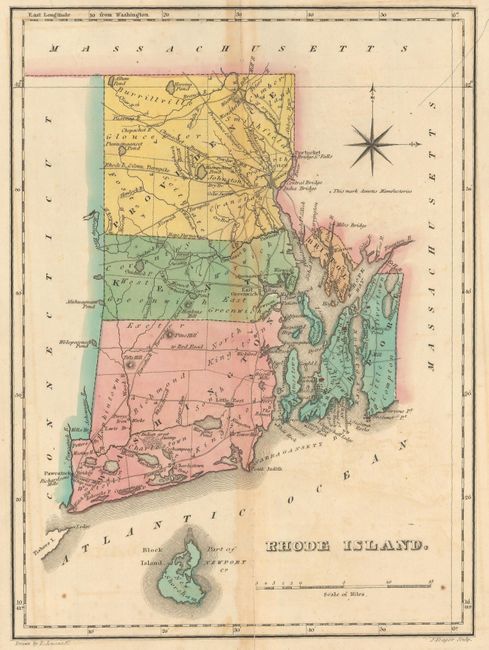
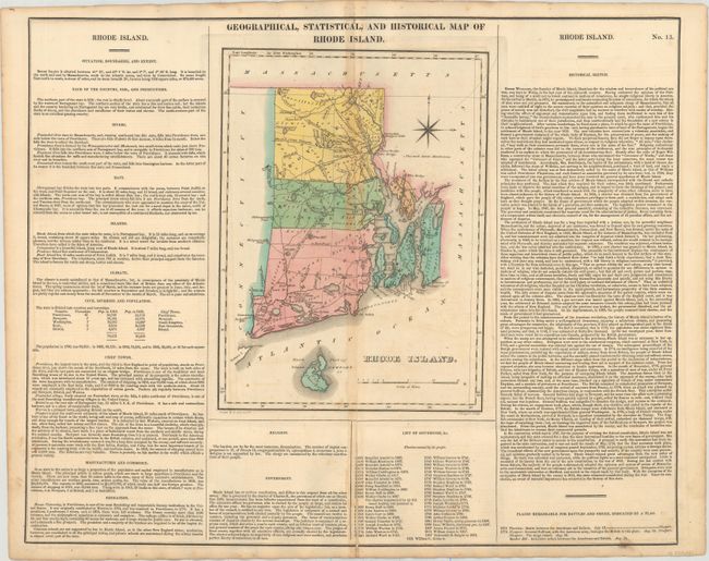
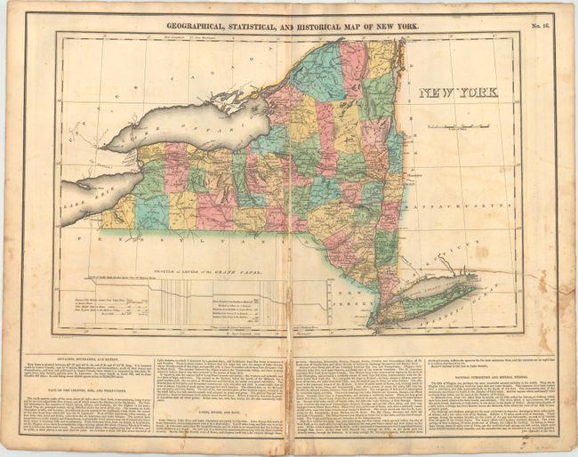
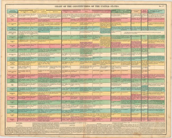
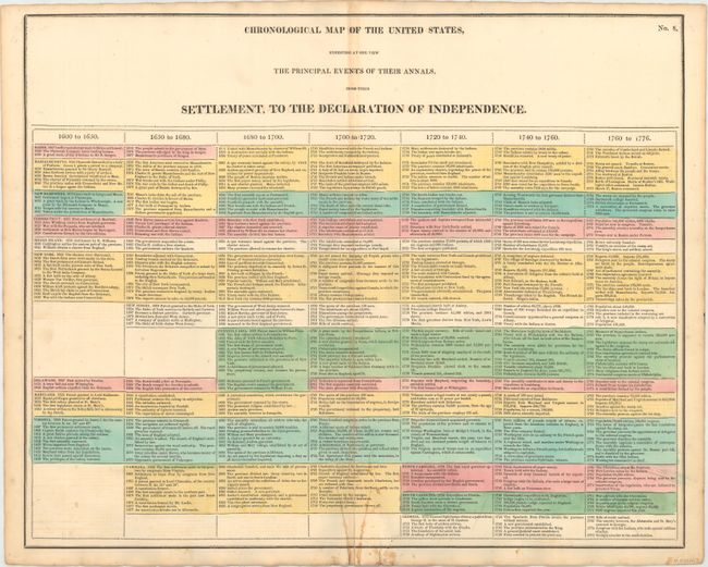
"[Lot of 4] Geographical, Statistical, and Historical Map of Rhode Island [and] Geographical, Statistical, and Historical Map of New York [and] Chart of the Constitutions of the United States [and] Chronological Map of the United States…", Carey & Lea

Subject: Eastern United States

Period: 1822 (circa)

Publication:

Color: Hand Color

Size:
See Description
Download High Resolution Image
(or just click on image to launch the Zoom viewer)

On sheets measuring approximately 21.8 x 17.5".

A. Geographical, Statistical, and Historical Map of Rhode Island, (8.4 x 11.4"). This map was beautifully drawn by F. Lucas and finely engraved by J. Yeager. It shows the state with a population of only 83,000 as compared to today's number of over one million. Five counties are named, and there is an adequate network of wagon roads. Newport, Little Rest, Bristol, Warren, and Providence are shown in a block layout. All of Block Island is shown to the south. Towns and settlements include Tower Hill, Charlestown, East Greenwich, and Pocasset. Among details are a powder mill, the Great Swamp, Perry's Iron Works, as well as turnpikes headed to Norwich, Connecticut, and Pawcatuck. Condition: There is a centerfold separation that extends 6" into the image partially closed on verso with old paper and light toning along the centerfold. (B)

B. Geographical, Statistical, and Historical Map of New York, (18.4 x 11.8"). Great early 19th century map of New York with "Profile of Levels of the Grand Canal" (Erie Canal) and descriptive text concerning the topography, natural curiosities, and more. Counties, roads, towns, rivers, and forts are included on map. Hamilton and Herkimer counties are labeled Wild Unsettled Country. County development is current for 1822 with the recent organization of Erie, Monroe, and Livingston counties. Condition: The map has almost completely separated along the centerfold, and has been partially (and poorly) repaired, resulting in some staining. There is also a 7" edge tear at right closed on verso with old paper. (C+)

C. Chart of the Constitutions of the United States, (20.9 x 16.8"). Condition: Short centerfold separation at bottom mostly closed on verso with old paper. (B+)

D. Chronological Map of the United States, Exhibiting at One View the Principal Events of Their Annals, from Their Settlement, to the Declaration of Independence, (20.6 x 16.6"). Condition: Short centerfold separation and an adjacent 2" tear at bottom closed on verso with paper tape. (B+)

References:

Condition:

See description above.

Estimate: $200 - $250

Sold for: $120

Closed on 2/18/2015

Archived