Catalog Archive
Auction 152, Lot 13

"Le Pave de la Grand Sale des Bourgeois", Anon.

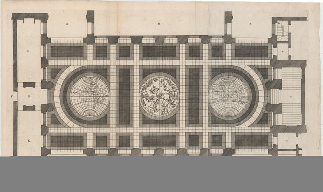
Subject: World & Celestial

Period: 1662 (circa)

Publication: Bouw Schilder en Beeldhouwkonst

Color: Black & White

Size:
29 x 17 inches
73.7 x 43.2 cm
Download High Resolution Image
(or just click on image to launch the Zoom viewer)

This unique sheet depicts three maps that were laid in the marble floor of Amsterdam Town Hall. At center is a celestial map of the northern sky with the Western and Eastern Hemispheres on either side. The maps are rudimentary with simple continental outlines and river systems shown. California is shown as an island as would be expected for a map of this period. In the Eastern Hemisphere is one of the earliest depictions of Abel Tasman's discovery of Tasmania. Tasman made those discoveries in 1642-43. However, it was several years before the results of the exploratory voyages were made public due to the secretive nature of the East India Company and their desire to maintain its monopoly on trade in the region. This map appeared in the French edition of Jacob van Campen's work detailing the Civic Hall of Amsterdam on thirty copper plates, Bouw Schilder en Beeldhouwkonst, van het Stadhuis te Amsteldam. Printed on two sheets, joined as issued.

References:

Condition: A

A sharp impression on watermarked paper with faint toning along one fold and a couple of minor fold separations in blank margins that have been archivally repaired. There are a few tiny tears in the right blank margin.

Estimate: $800 - $950

Sold for: $600

Closed on 2/18/2015

Archived