Catalog Archive
Auction 152, Lot 104

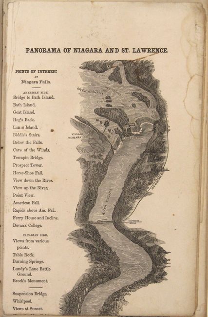
"The River St. Lawrence, in One Panoramic View, from Niagara Falls to Quebec, Together with Descriptions and Illustrations of the Thousand Islands, Cities in Canada...",

Subject: Eastern Canada, Niagara Falls

Period: 1859 (circa)

Publication:

Color: Black & White

Size:
6 x 9.5 inches
15.2 x 24.1 cm
Download High Resolution Image
(or just click on image to launch the Zoom viewer)

This unusual guide book contains a strip map measuring over 10 feet (!) in length that covers the region from Niagara Falls to Quebec City, traveling along the Niagara River, Lake Ontario, and the St. Lawrence River. The map is richly illustrated with numerous ships and boats in route and identifies towns, cities, and important sights along the way. Below the map image is an advertisement for the "Round Hill Water Cure and Hotel" in Northampton, MA. Includes 70-pages of text with a number of full page illustrations describing the journey and the many points of interest along the way. Published by Alex. Harthill and Company in New York. Hardbound in blue cloth over marbled boards.

References:

Condition: B

Condition code is for the map which has several brown adhesive stains where the sheets were joined to form the strip map. Text and plates are very good with some minor staining and soiling. Binding is excellent.

Estimate: $200 - $230

Sold for: $150

Closed on 2/18/2015

Archived