Catalog Archive
Auction 151, Lot 596

"[On 2 Sheets] Empire Ottoman", Andriveau-Goujon, E.

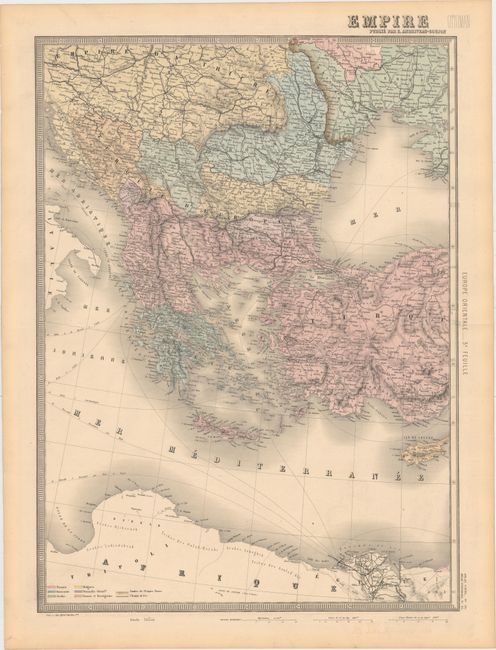
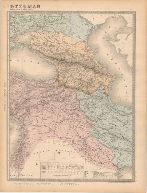
Subject: Ottoman Empire

Period: 1879 (dated)

Publication: Atlas Universel

Color: Hand Color

Size:
17.9 x 24.6 inches
45.5 x 62.5 cm
Download High Resolution Image
(or just click on image to launch the Zoom viewer)

This striking two-sheet map of the Ottoman Empire centers on Turkey and covers the area from the Balkans to the Caspian Sea. Fine topographical detail, numerous place names, roads, railroads (both completed and under construction), ancient place names, ruins, and more are located with the help of a key at bottom on the right sheet. A chart on the same sheet provides translations of important geographic terms into Russian, Turkish, Persian, and Arabic. Printed by Alfred Chardon Jr. and engraved by Smith, Gerin, Rousset, and Fontaine.

References:

Condition: A

Attractive original color with minor printer's ink residue and toning along the sheet's edges.

Estimate: $240 - $300

Sold for: $100

Closed on 11/19/2014

Archived