Catalog Archive
Auction 151, Lot 346

Rare First State of Dudley's Chart of Honduras and Nicaragua

"Carta Particolare dell' Mare del' Zur che Comincia con il Capo Lucar e Finisce con Cagidos nella Nuova Spagnia, e la Baia di Honduras…", Dudley, Robert (Sir)

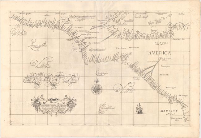
Subject: Central America

Period: 1646 (circa)

Publication: Dell' Arcano del Mare

Color: Black & White

Size:
29.4 x 18.7 inches
74.7 x 47.5 cm
Download High Resolution Image
(or just click on image to launch the Zoom viewer)

This elegant sea chart is crisply engraved in the sparse Florentine style with superb calligraphy throughout. The map covers a portion of Central America, extending along the Caribbean Sea from the Bay of Honduras to Cape Camaron, and along the Pacific Ocean from southern Mexico to Nicaragua. The coasts are filled with place names, rocks, anchorages, and soundings. Short navigational notes are indicated throughout the chart. A large compass rose and a strapwork title cartouche embellish the chart. Engraved by A.F. Lucini. This is the first state. Printed on two joined sheets, as issued.

Robert Dudley was the first Englishman to produce a sea atlas, Dell Arcano del Mare (Secrets of the Sea). A skilled mathematician and navigator, Dudley was exiled from England and settled in Florence where his atlas was published. He introduced a totally new style for sea charts in the atlas with only lines of latitude and longitude and no rhumb lines. The charts were meticulously compiled from original sources and were both scientific and accurate for the time. This important atlas was the first sea atlas of the whole world; the first to use Mercator's projection throughout; the earliest to show the prevailing winds, currents and magnetic deviation; and the first to expound the advantages of Great Circle Sailing. In an introductory leaf found in one copy in the British Library, the engraver states that he worked on the plates in seclusion for twelve years in an obscure Tuscan village, using no less than 5,000 pounds of copper for the printing plates. It was only issued in two editions and the maps are rarely seen on the market.

References: Kapp (MCC-103) #8; Shirley (BL Atlases) M.DUD-1a #143.

Condition: B+

Watermarked paper with good, original margins, minor foxing, and one short fold separation closed on verso with archival material.

Estimate: $1,600 - $2,000

Sold for: $1,200

Closed on 11/19/2014

Archived