Catalog Archive
Auction 150, Lot 712

"[Lot of 3] Johnson's Australia and East Indies [and] Oceanica [on sheet with] Australia and New Zealand [and] West Australia [on sheet with] South Australia [and] New Zealand South Island",

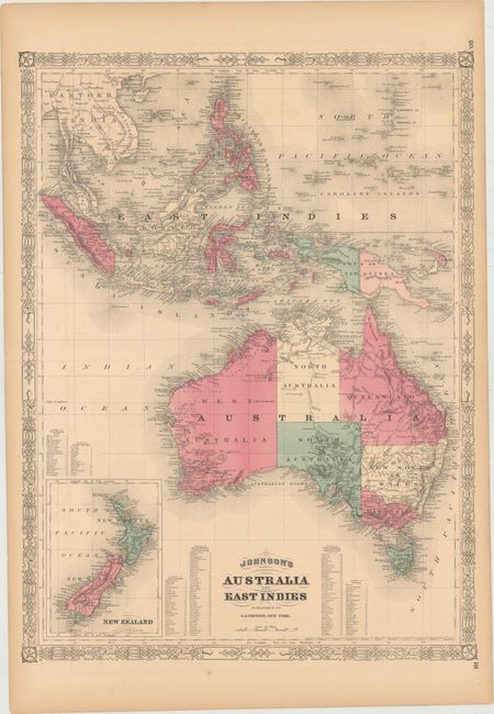
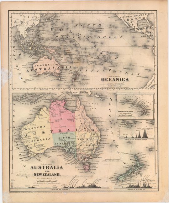
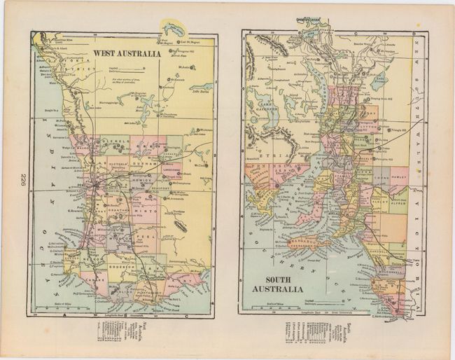
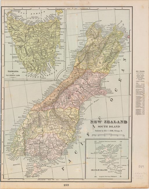
Subject: Australia, New Zealand

Period: 1860-98 (circa)

Publication:

Color:

Size:
See Description
Download High Resolution Image
(or just click on image to launch the Zoom viewer)

A. Johnson's Australia and East Indies, by A.J. Johnson, from New Illustrated Family Atlas of the World, dated 1867, hand color (17.1 x 22.9"). Very striking and colorful map shows Australia divided into seven states/territories including a huge Queensland, New South Wales, Victoria, Van Diemens Land, and West, North, and South Australia. The southeast and southwest regions are more heavily settled than the rest of the continent, where only harbors are located around the coasts, and little or no settlement appears in interior regions. An inset in lower left depicts New Zealand with its three islands named New Ulster, New Munster, and New Leinster. Tables of the counties in Van Diemens Land, South Australia, West Australia, New South Wales, Queensland, and Victoria are also included, keyed to the map.

To the north of Australia lie the East Indies drawn in fine detail from the Gulf of Siam, Cambodia, and Cochin China down to Sumatra, Java, Borneo, the Celebes Islands, and the Philippines. The map also shows the Ladrone or Mariana Islands with Guam at their southernmost tip. Also included are tables of counties in the Australian Commonwealth regions of New South Wales, Victoria, Queensland, and Western Australia. The map is surrounded by decorative borders. Ref: Tooley (Australia) p. 102 #754. Condition: Minor offsetting and short centerfold separations at left and right, away from image. There are some short edge tears and light toning, primarily in the blank margins. (B+)

B. Oceanica [on sheet with] Australia and New Zealand, by Joseph Hutchins Colton, from Colton's School Atlas, dated 1860, hand color (9.9 x 12.1"). Two maps on one sheet depicting Australia and New Zealand with an inset chart of the Sandwich Islands (Hawaii). Australia is divided into six provinces with minimal interior detail. The chart includes comparative profile views of the mountains in Australia, New Zealand, and Hawaii. The upper map, titled Oceanica, depicts the entire Pacific Ocean extending from China, Japan, and the United States in the north to Australia, New Zealand, and the southern tip of South America in the south. There is great detail of all the islands in the North and South Pacific. On the verso is a handsome map of Africa with an inset of Liberia. Ref: cf Tooley (Australia) p. 44, #313. Condition: Light foxing and soiling with two damp stains in blank margins, one of which enters map border at left. (B)

C. West Australia [on sheet with] South Australia [and] New Zealand South Island, by George F. Cram & Company, from Cram's Superior Atlas of the World Indexed, circa 1898, printed color (13.5 x 21.1"). This late 19th century sheet features three maps of the region that include major cities, mountains, rivers, lakes, and railways. The maps of West and South Australia are divided into counties, while the New Zealand map is divided into provinces. The New Zealand map includes two insets: Tasmania or Van Diemens Land at top left and Chatham Islands at bottom right. There is a map of northeast Africa on verso. Condition: There is faint scattered foxing and a few light extraneous creases, all on the map of New Zealand. (B+)

References:

Condition:

See description above.

Estimate: $150 - $180

Sold for: $110

Closed on 9/17/2014

Archived