Catalog Archive
Auction 150, Lot 607

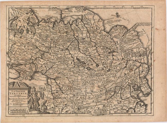
"La Grande Tartarie, Suivant les Nouvelles Observations de Messrs. de l'Academie Royale des Sciences, etc. Augmentees de Nouveau", Aa, Pieter van der
Subject: Northern Asia

Period: 1714 (circa)

Publication: Nouvel Atlas Tres Exact

Color: Black & White

Size:
11.8 x 8.9 inches
30 x 22.6 cm
Download High Resolution Image
(or just click on image to launch the Zoom viewer)

This is a great small map of the northern parts of Asia extending from the Black Sea through northern China and Korea. The map is filled with an amazing amount of detail for its size. Terre de Jelmer, "discovered in 1664 by Corn Jelmerse Kok," forms a bridge between Novaya Zemlya and the mainland east of the Yenisey estuary. Witsen's Icy Cape protrudes in the Arctic Ocean. The pictorial title cartouche features a Cossack encampment.

References:

Condition: B+

A dark impression issued folding with light scattered foxing and minor toning.

Estimate: $150 - $180

Sold for: $90

Closed on 9/17/2014

Archived