Catalog Archive
Auction 150, Lot 521

Blaeu's Strip-Map of the Dnieper River

"Lectori S. Hunc Borysthenis Tractum ut ad Nostrum Geographiae Tabulam…", Blaeu, (Family)

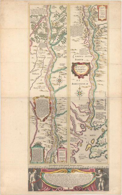
Subject: Dnieper River, Ukraine

Period: 1640 (circa)

Publication:

Color: Hand Color

Size:
12.8 x 29.6 inches
32.5 x 75.2 cm
Download High Resolution Image
(or just click on image to launch the Zoom viewer)

Superb, large map showing the course of the Dnieper River from Cherkasy to the estuary on the Black Sea. The map is in strip style with two vertical maps following the course of the river, each decorated with cartouches and compass roses and including numerous lengthy notations describing the cataracts, cities, salt mines, fortresses, and the historical traditions of the Kozaks. Putti flank a large cartouche at bottom. This map is based on an inset map from the important Radziwill-Makowski map of the Duchy of Lithuania (1613), which was the most accurate map of Lithuania and served as a resource for all other maps of the region for 150 years. Blaeu first published the map, along with the inset of the Dnieper River, as a four-sheet map in his Appendix in 1631. The map of Lithuania and the strip map of the Dnieper River then appeared separately in subsequent Blaeu atlases. Engraved by Hessel Gerritsz. Two sheets joined, as issued. Blank verso.

References: Ukraine in Old Maps pp. 188-89; Van der Krogt (Vol. II) #1730/II:2A.

Condition: B+

Original color on watermarked paper with minor soiling, some extraneous creases, and a small hole along the centerfold to the right of the river in the left-hand strip.

Estimate: $1,600 - $2,000

Sold for: $1,600

Closed on 9/17/2014

Archived