Catalog Archive
Auction 150, Lot 456

"Flandriae Comitatus in Ejusdem Subjacentes Ditiones Accuratissime Divisus una cum Adjacentibus", Visscher, Nicolas

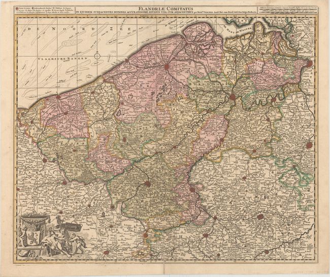
Subject: Western Belgium

Period: 1700 (circa)

Publication:

Color: Hand Color

Size:
22.9 x 19.3 inches
58.2 x 49 cm
Download High Resolution Image
(or just click on image to launch the Zoom viewer)

This map of the historical region of Flanders traces the coastline from Grevelingen to Zeeland at de Hont oste Westerschelde, south to below Douay, and east to Brussels. Beautifully engraved and highly detailed, the map shows political divisions, forests, roads, canals, hundreds of tiny villages, and several fortified towns including Brussels and Antwerp. A purely decorative cartouche appears at bottom left, featuring a Belgian lion coat-of-arms and allegorical figures.

References:

Condition: B+

A nice impression with original color. There is a centerfold separation that enters 0.5" into the image at bottom that has been closed on verso with tape and an extraneous crease parallel to the centerfold. There is faint show-through of a stamp on verso at top and a short edge tear that just enters into the title.

Estimate: $350 - $450

Sold for: $180

Closed on 9/17/2014

Archived