Catalog Archive
Auction 150, Lot 448

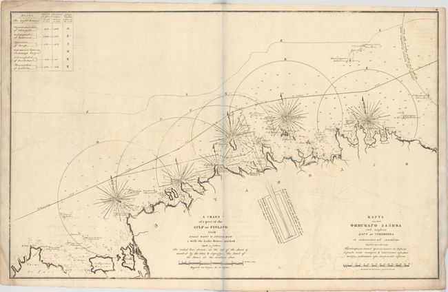
"A Chart of a Part of the Gulf of Finland from Island Dago to Stoneskar & with the Light Houses Marked...",

Subject: Estonia, Gulf of Finland

Period: 1817 (circa)

Publication: Atlas of the Gulf of Finland containing the South Coast...

Color: Black & White

Size:
36.5 x 23 inches
92.7 x 58.4 cm
Download High Resolution Image
(or just click on image to launch the Zoom viewer)

This large, uncommon chart of a stretch of Estonian coastline is by Leontiy Spafaryev (often spelled in English as "Spafarief" or "Spafarieff"), cartographer of the Russian Admiralty. It extends from the northern part of the island of Hiiumaa (Dago) to east of Eru Bay. Small islands, soundings, hazards, anchorages, and other navigational details are included. Several lighthouses are identified in the middle of semicircles that show their range, and the Catherendal Lighthouse is shown in plan form. This unusual emphasis on lighthouses is unsurprising given that Spafaryev organized the system of lighthouses as the head of the Lighthouse Administration. Much of the map's information is offered in English and Russian, including the title.

References:

Condition: B

On watermarked paper (dated 1813) with moderate offsetting and minor soiling especially concentrated around the corners of the sheet. The bluish line that appears in the image is caused by the scanner and not on the actual map.

Estimate: $275 - $375

Sold for: $200

Closed on 9/17/2014

Archived