Catalog Archive
Auction 150, Lot 426

"[On 2 Sheets] England and Wales Drawn from the Most Accurate Surveys Containing All the Cities Boroughs Market Towns & Villages...", Rocque, John

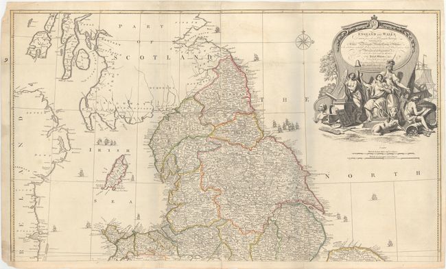
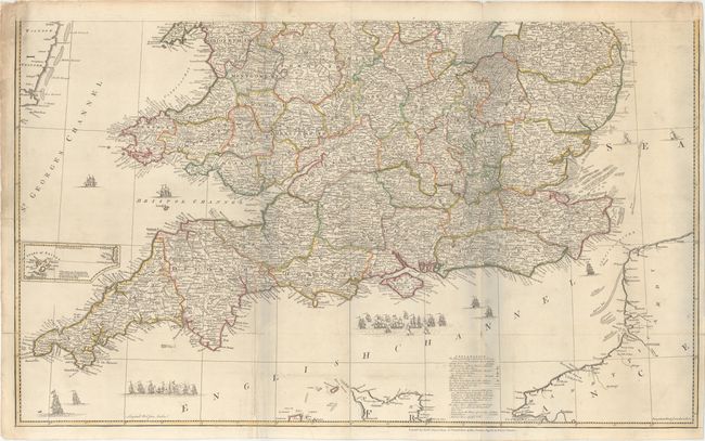
Subject: England & Wales

Period: 1761 (circa)

Publication: General Atlas

Color: Hand Color

Size:
38.9 x 23 inches
98.8 x 58.4 cm
Download High Resolution Image
(or just click on image to launch the Zoom viewer)

Large and magnificent four sheet map filled with remarkable details down to the smallest village. The map shows hundreds of roads with distance information between towns. The legend identifies numerous physical features through icons for towns and villages by size, local markets, astronomical observation sites, and more. The large title cartouche with fancy lettering depicts Britannia holding a staff with the liberty cap, Athena, Hermes, an angel with a harp and a book of Shakespeare, a lion with a trident, surveying instruments, a globe, etc. The seas are embellished with numerous sailing ships and a fine compass rose. The imprint of Robert Sayer Map & Printseller at the Golden Buck in Fleet Street appears below the neatline at bottom. As issued with two sheets joined to form a two-part map. When top and bottom are joined, the map will measure approximately 39 x 46".

References:

Condition: B+

A nice impression with attractive color and minor soiling. There are a few short fold separations and edge tears that enter about 1" to 2" into map that have been closed on verso with archival material. There are pale blue shadows along the folds which are caused by our scanner and to not appear on the map itself.

Estimate: $550 - $700

Sold for: $400

Closed on 9/17/2014

Archived