Catalog Archive
Auction 150, Lot 408

"[On 2 Sheets] A New and Accurate Map of Europe. Divided Into Its Empires, Kingdoms, States and Republics, &c. Drawn by the Sieur Robert de Vaugondy...", Kitchin, Thomas
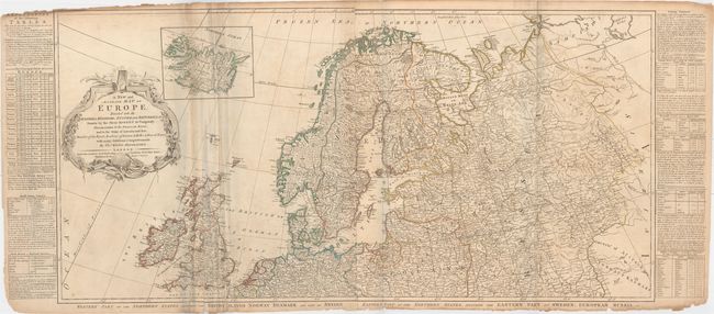
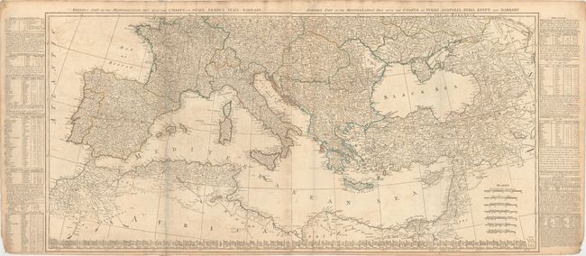
Subject: Europe

Period: 1772 (dated)

Publication: General Atlas

Color: Hand Color

Size:
41.6 x 20.4 inches
105.7 x 51.8 cm
Download High Resolution Image
(or just click on image to launch the Zoom viewer)

This is Kitchin's version of Robert de Vaugondy's detailed four-sheet map of Europe. Named places are shown in abundance and boundaries are included. An inset of Iceland appears above the decorative title cartouche. Tables at sides provide a wealth of information on the major empires, and the flags of all the nations are aligned along the bottom of the southern sheet. This edition was published by Robert Sayer. Printed on four sheets (joined to form two pairs) as issued.

References: Phillips (A) #653-3 & 4.

Condition:

Original color on watermarked paper with light offsetting, minor soiling, and small chips at bottom. The southern sheets are in "B" condition with two fold separations entering 1/2" and 3" into map at bottom. The northern sheets are in "C+" condition with significant extraneous creases along the left-hand fold and a 5" fold separation at bottom that has been archivally repaired.

Estimate: $500 - $700

Sold for: $300

Closed on 9/17/2014

Archived