Catalog Archive
Auction 150, Lot 352

"Plan de l'Isle de la Grenade...", Jefferys, Thomas
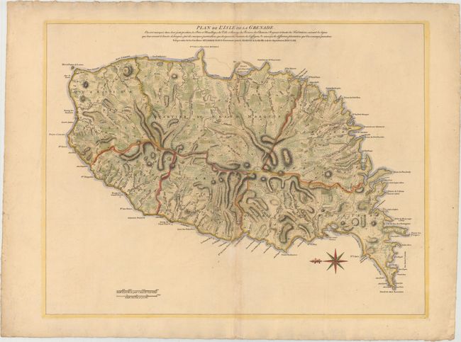
Subject: Grenada

Period: 1763 (dated)

Publication:

Color: Hand Color

Size:
25 x 19.1 inches
63.5 x 48.5 cm
Download High Resolution Image
(or just click on image to launch the Zoom viewer)

Thomas Jefferys was one of the most important English map publishers of the 18th century. His work included prints and maps of locations around the world, but his most notable maps are of North America and the West Indies. He began his career in the map trade in the early 1730s, working as an engraver for a variety of London publishers, and eventually setting up his own shop. In 1746, he was appointed Geographer to the Prince of Wales, and in 1760 he became Geographer to the King. These titles granted access to manuscripts and cartographic information held by the government. In the early 1760s he embarked on an ambitious project to produce a series of English county maps based on new surveys, but ran out of money and filed for bankruptcy in 1766. He then partnered with London publisher Robert Sayer, who reissued many of Jefferys plates and continued to issue new editions after Jefferys' death in 1771. Jefferys' American Atlas and the accompanying West-India Atlas, published post posthumously, are considered his most important cartographic works.

Large-scale topographical map of this mountainous island in the Windward Islands with great detail of the roads, plantations, villages, ports and fortifications. The coastlines are well delineated and include the locations of safe harbor and soundings in the bays. The map has a striking compass rose orienting the map with north to the left. The French and British struggled for dominance of the island through much of the 18th century. It was captured by the British in 1762, during the Seven Years' War, and formally ceded to Great Britain in 1763 through the Treaty of Paris. The British governor of Grenada and the Windward Islands, George Scott, ordered the survey shown on this map. This is a French edition of Jefferys' map that was published in A General Topography of North America and the West Indies.

References: Tooley (MCC-62) #24.

Condition: B+

A nice impression on watermarked paper with attractive color and light toning along centerfold.

Estimate: $475 - $600

Sold for: $240

Closed on 9/17/2014

Archived