Catalog Archive
Auction 150, Lot 279

"The State of Rhode Island, from the Latest Surveys", Reid, John

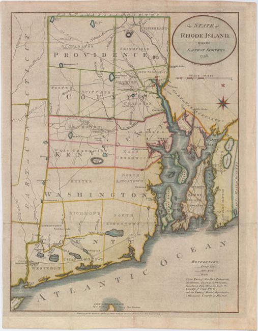
Subject: Rhode Island

Period: 1796 (dated)

Publication: Winterbotham's America

Color: Hand Color

Size:
12.9 x 17 inches
32.8 x 43.2 cm
Download High Resolution Image
(or just click on image to launch the Zoom viewer)

One of the earliest American-published maps of Rhode Island. The map was engraved by Benjamin Tanner for John Reid's rare American Atlas. The map depicts county boundaries, townships, topography, churches, mills, shipyards, roads and bridges. It also shows several swamps and a Quicksand Pond, which on this map is located entirely in Massachusetts, whereas earlier maps showed it in Rhode Island.

References: Phillips (A) #1216-8; Wheat & Brun #254.

Condition: B+

Issued folding, now pressed, with light soiling, a hint of offsetting, and archival repairs to a few tiny fold separations.

Estimate: $400 - $475

Sold for: $250

Closed on 9/17/2014

Archived