Catalog Archive
Auction 150, Lot 263

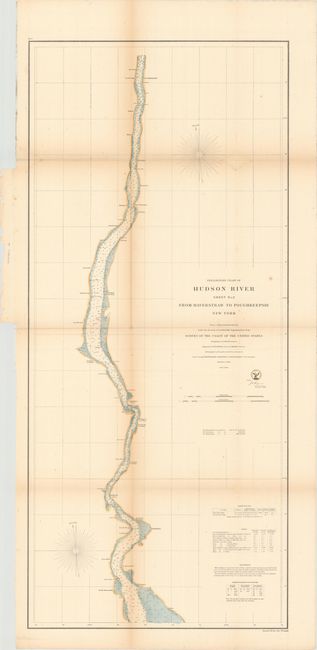
"Preliminary Chart of Hudson River Sheet No. 2 from Haverstraw to Poughkeepsie New York", U.S. Coast Survey

Subject: Hudson River, New York

Period: 1861 (dated)

Publication:

Color: Hand Color

Size:
17.4 x 38.9 inches
44.2 x 98.8 cm
Download High Resolution Image
(or just click on image to launch the Zoom viewer)

The Office of Coast Survey is the oldest U.S. scientific organization, dating from 1807 when Congress directed that a "survey of the coast" be carried out. By 1836, it was called the U.S. Coast Survey and in 1878, the name was changed to the U.S. Coast and Geodetic Survey. Today the Office of Coast Survey is a division of the National Oceanic and Atmospheric Administration NOAA.

The survey teams, composed of civilians as well as Army and Naval officers, charted the nation's waterways and produced a wide array of reports, survey charts, hydrographic studies of tides and currents, astronomical studies and observations, and coastal pilots. These charts are an important record of the changing nature of the nation's coastlines. In additional to coastal charts, the U.S. Coast and Geodetic Survey produced land sketches, Civil War battle maps, and the early aeronautical charts.

This informative chart shows the span of the Hudson River in New York from just north of Poughkeepsie to south of Haverstraw. There are numerous soundings and bottom types identified in the river, with keys at bottom right to help interpret the information. Another key provides in-depth data on the tides. Several locations are named along the river, including West Point and various landings. Two lighthouses are noted, one at West Point and another at Stony Point.

References:

Condition: B+

Issued folding and now backed in tissue to repair several short fold separations. There is light toning along the folds and faint scattered foxing.

Estimate: $150 - $180

Unsold

Closed on 9/17/2014

Archived