Catalog Archive
Auction 150, Lot 190

"Map of the Southern Parts of the United States of America", Bradley, Abraham Jr.

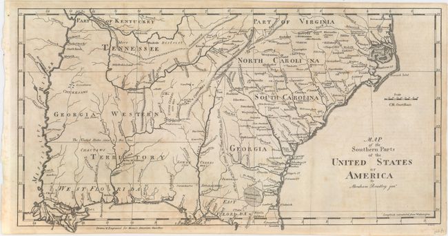
Subject: Southern United States

Period: 1797 (published)

Publication: Morse's American Gazetteer

Color: Black & White

Size:
15.2 x 7.8 inches
38.6 x 19.8 cm
Download High Resolution Image
(or just click on image to launch the Zoom viewer)

First edition of this interesting map of the South during the tumultuous period following independence when the states and central government fought over control of the western land claims. Seven of the 13 original states had claims to areas in the West (those lands between the Appalachian Mountains and the Mississippi River). These so-called landed states had a great potential advantage over the six landless states. It was assumed that the future sale of western lands would enrich the landed states and possibly allow them to operate without any form of taxation. The landless states feared that they would lose residents and dwindle into insignificance. The matter was further complicated by the fact that the claims often overlapped one another, which pitted one state's interests against another. On this map the region of present-day Mississippi and Alabama is labeled Georgia Western Territory, with the coastal region named West Florida. A dotted line running north-south through present-day Georgia demarcates "All West of this line is claimed by the United States & also by Georgia." Another dotted line running east-west from the Chatahouchee R. to the Mississippi River is labeled, "The United States claim to this line." These overlapping claims were resolved when Spain gave up its claim to West Florida in 1795 and Georgia finally relinquished its claim in 1802 (the last of the landed states to surrender its claim).

References: Wheat & Brun #496.

Condition: B+

Issued folding with light offsetting.

Estimate: $325 - $400

Sold for: $325

Closed on 9/17/2014

Archived