Catalog Archive
Auction 149, Lot 39

"[Lot of 2] Hemisphere Septentrional pour Voir Plus Distinctement les Terres Arctiques [and] Hemisphere Meridional pour Voir Plus Distinctement les Terres Australes", Delisle/Covens & Mortier
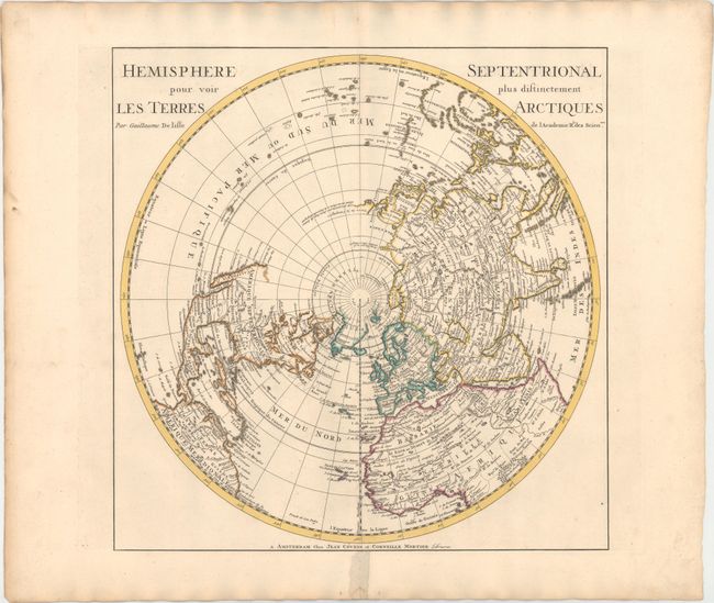
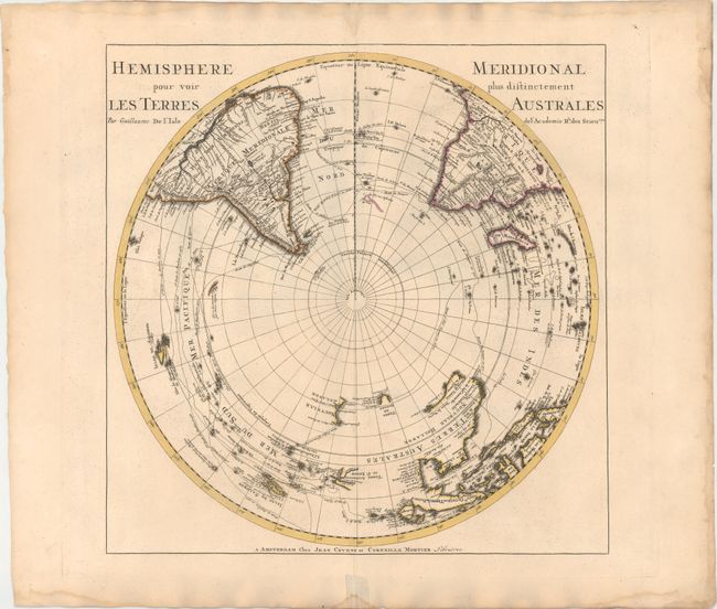
Subject: Polar

Period: 1730 (circa)

Publication:

Color: Hand Color

Size:
18 x 18.3 inches
45.7 x 46.5 cm
Download High Resolution Image
(or just click on image to launch the Zoom viewer)

This is a matching set of north and south polar hemispheres originally produced by Guillaume Delisle in 1714, here re-published by Covens and Mortier.

This important map of the Northern Hemisphere is drawn with Delisle’s characteristic scientific approach. This is the first map to correctly place the west coast of North America, moving it substantially east from previous mapping. California is shown as a peninsula at a time when it was often still shown as an island, even in other maps drawn by Delisle, although a dotted line still hints at the possibility of the island form. Near the northern coast of Asia is Terre de la Compagnie with a note about its discovery by Jean de Gama. Delisle based his depiction of the Northern Pacific on the voyage of Fondant in 1709.

Delisle's map depicting the Southern Hemisphere shows the tracks of the explorers and circumnavigators around the southern oceans including Magellan in 1520, Abel Tasman in 1642, and Edmund Halley in 1698-1700. The map provides very good detail, particularly of the explorations and discoveries in the South Pacific. Australia, New Guinea, Tasmania, and New Zealand are partially delineated, with Australia and New Guinea nearly attached to one another.

References: Wagner #504; Tooley (Australia) p. xxxi, #45.

Condition: A

Fine impressions with original color on watermarked paper. There are damp stains along sheet edges, far from image, and old paper repairs along centerfold in bottom blank margin on recto.

Estimate: $1,100 - $1,400

Sold for: $650

Closed on 5/21/2014

Archived