Catalog Archive
Auction 149, Lot 358
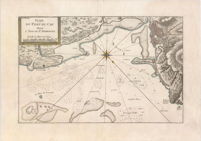
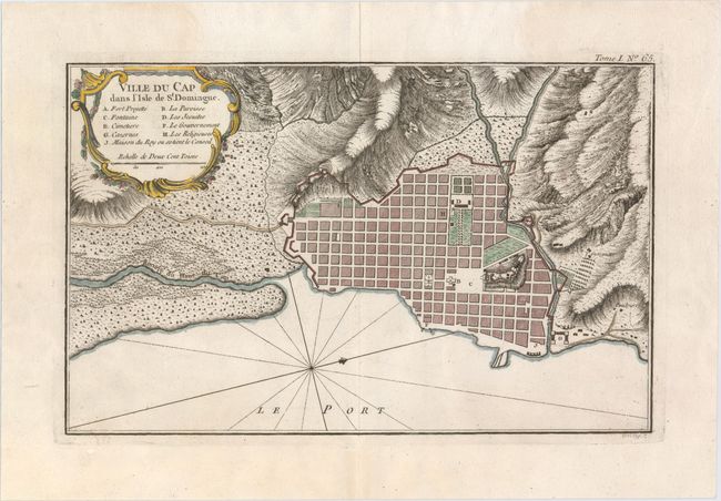
"[Lot of 2] Plan du Port du Cap dans l'Isle de St. Domingue [and] Ville du Cap dans l'Isle de St. Domingue", Bellin, Jacques Nicolas
1 of 2
Subject: Haiti
Period: 1764 (circa)
Publication: Le Petite Atlas Maritime
Color: Hand Color
Size:
14.2 x 9.1 inches
36.1 x 23.1 cm
Download High Resolution Image
(or just click on image to launch the Zoom viewer)
(or just click on image to launch the Zoom viewer)